Mine Creek - September 28, 2016 - Inyo National Forest - Hoover Wilderness Area
Yosemite National Park encompasses the upper watersheds of two rivers draining the west slopes of the Sierra Nevada. The Merced River drains the park's southeast mountains before flowing famously through Yosemite Valley. The Tuolumne River, less famous though far from obscure, drains the more northern peaks through Tuolumne Meadows before cutting a canyon down to Hetch Hetchy Reservoir, the infamous water source for the city of San Francisco.
Highway 120, better known as the Tioga Pass Road, follows the Tuolumne River through Tuolumne Meadows to Tioga Pass. At 9943 feet, this is the highest highway pass in the Sierras and is also the border between Yosemite and Inyo National Forest. The pass itself is barely perceptible, the road dropping only slightly as it heads east into national forest land. This high country just outside Yosemite is one of my favorite parts of the Sierra Nevada, or any other mountain range for that matter.
The hike starts
straight out of the campground, always nice. The trail is signed
“Bennettville”, as the first mile leads to the sparse remains of a nineteenth-century mining town, the attraction for most
people. But beyond Bennettville the trail heads quickly and easily out
of the trees and in no time emerges into an extraordinary basin of
lakes, the imposing granite of Mount Conness, White Mountain, and North Peak luring from the distance. I immediately thought and not for the first
time how easy Sierra hikers can have it compared to those in the
Cascades. I know there is plenty of tough hiking in the Sierras, but
quick jaunts to landscapes like this are far from uncommon.
Yosemite National Park encompasses the upper watersheds of two rivers draining the west slopes of the Sierra Nevada. The Merced River drains the park's southeast mountains before flowing famously through Yosemite Valley. The Tuolumne River, less famous though far from obscure, drains the more northern peaks through Tuolumne Meadows before cutting a canyon down to Hetch Hetchy Reservoir, the infamous water source for the city of San Francisco.
Highway 120, better known as the Tioga Pass Road, follows the Tuolumne River through Tuolumne Meadows to Tioga Pass. At 9943 feet, this is the highest highway pass in the Sierras and is also the border between Yosemite and Inyo National Forest. The pass itself is barely perceptible, the road dropping only slightly as it heads east into national forest land. This high country just outside Yosemite is one of my favorite parts of the Sierra Nevada, or any other mountain range for that matter.
I arrived rather late in the season for such a high altitude. Nighttime lows
were forecast to drop into the low 30s or upper 20s. The days were
lovely though so I took one of the last sites available at Junction
Campground (9600') in order to get in one hike. On my last visit,
eight years earlier, I hiked into what is known as 20 Lakes Basin.
Actually I hiked there twice. This time I headed up Mine Creek, the
next drainage over to the west.
 |
| Bennettville |
 |
| Mine Creek |
 |
| Shell Lake |


The weather was spectacular. Lush grass surrounded Shell Lake. Some autumn tints flashed in the hills and bits of snow prevailed on the higher slopes. Mine Creek is a narrow little treat, running free of impoundment. It is a tributary of Lee Vining Creek, though, so its waters go on to produce electricity at the power station in Lee Vining Canyon before being diverted, most of it anyway, to the Los Angeles Aqueduct for the long ride to that city's water supply.
I met a couple of
people heading up the trail with fishing poles, saying the creek held a lot of trout. I soon saw what they meant and was indeed taken,
both by their numbers and their size. There were buckets of them and
they were tiny, hardly fish at all. They were so close to
the bank and to each other that I figured it would be more efficient
to just dip a net and scoop some out. You'd need a few of them if you
were looking for dinner. I don't know if that would be sporting or
even legal; I never did take up fishing.

It was lake after lake - Shell Lake, Fantail Lake, Finger Lake, Spuller Lake - I lost track.


 |
| Saddlebag Dam (got to look close) |
It was easy pickings
down into a wetlands area still quite wet in
late September. I figured this was good news for our drought-stricken
Californians, though I don't really know what would be considered
normal. Maybe this should still have been snow.


At this point I wasn't really trying to get anywhere. It was now a hike to wander and absorb. I circled around another lake or two, then began climbing back up toward the Mine Creek divide. I was surprised to find myself short of breath and rather exhausted, just from strolling around some easy meadows. It dawned on me that I had been over 10,000 feet the entire day, in the sun the whole time, and that elevation and exposure had taken their toll. So much for my Cascadian condescension.
I found some shade and rested a bit, looking back over the lakes toward the way I came in, with the Tioga Pass peaks and Mount Dana in the background. By this time the beautiful day was showing some cracks; it was getting downright cloudy. I started my dawdle back in a light sprinkle, taking time to look more closely at the rocks. Somehow it had become more autumnal over the course of the day. Goodbye to Bennettville and back to the tent for a cold night.


 |
| Bennettville |
Tuolumne Meadows and River - September 29 and 30, 2016 - Yosemite National Park
To gain a modicum of warmth I moved to Yosemite's Porcupine Flat campground - 1,500 feet lower than Junction - and spent the next couple of days kicking around the Tuolumne Meadows and river. Tuolumne Meadows really is strolling unless you choose to climb one of the many domes distant or near. Wandering the river in its late season sluggishness, with Lembert Dome the obvious focal point, Dana and Gibbs peaks in the background. Conifer saplings revealed that Tuolumne Meadows, like all meadows, is temporary.
 |
| Lembert Dome |
 |
| Lembert Dome, Dana Peak, Mount Gibbs |
 |
| Tuolumne River, Lembert Dome |

 |
| Conifers on the march |
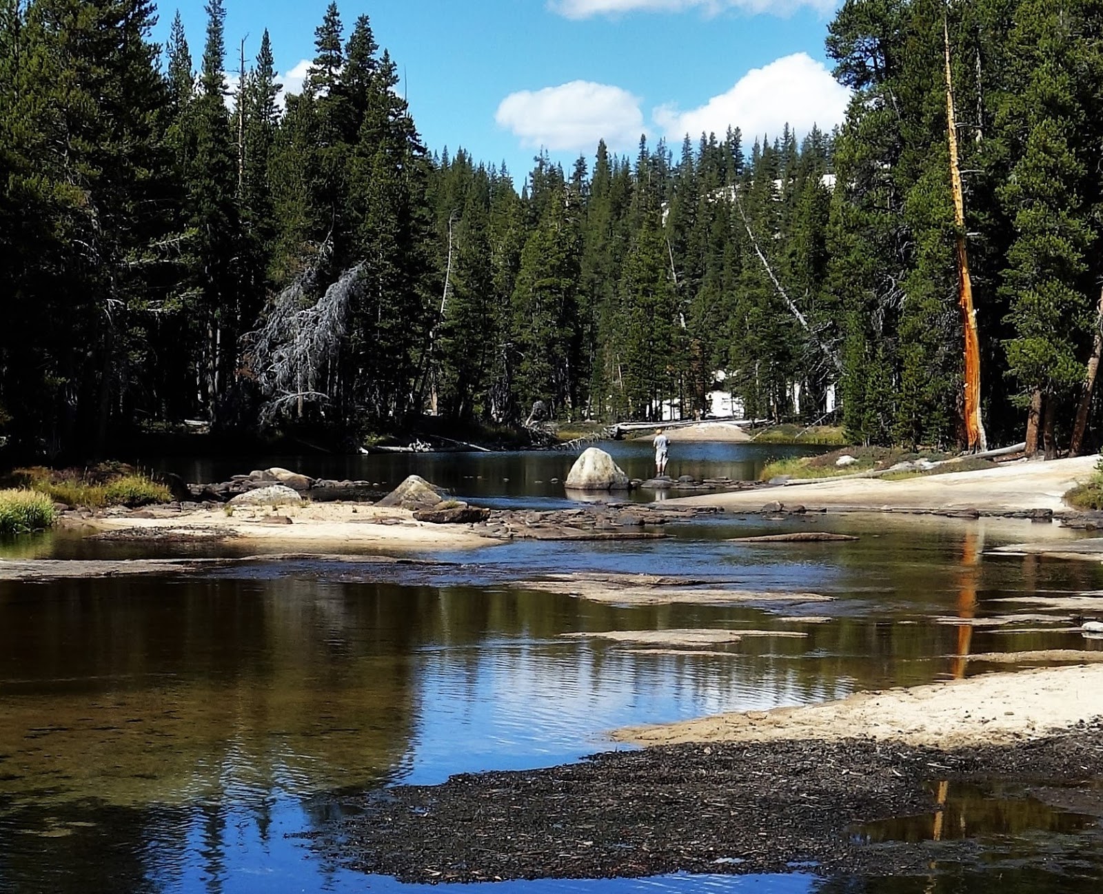 |
| Tuolumne River |
 |
| Tuolumne River |
 |
| Tuolumne River Bed |


 |
| Glen Aulin Trail |
I was enjoying a
late breakfast at the campground when out of the bush popped a park
ranger. First she chided me for wandering too far from my picnic
cooler. You're supposed to keep within arm's length of them and try
sometime to prepare dinner that way. Then she told me a storm was
coming in, snow and wind, possibly closing the road. I would have to
pick up and drop down lower, down into Lee Vining Canyon. I might
still get snowed on but at least I wouldn't be stranded in Yosemite.
No comments:
Post a Comment