4/5/09
Sedona was as beautiful and crowded as its reputation promised. The beauty was somewhat undermined when I was there, and the congestion exacerbated, by an enormous road construction project that turned half the downtown thoroughfare, the half with the art galleries as it happened, into a nerve-rattling gauntlet of narrow lanes, no shoulders, traffic cones, blockades, dust, construction workers and backhoes, not to mention befuddled tourists, myself included.
Sedona was as beautiful and crowded as its reputation promised. The beauty was somewhat undermined when I was there, and the congestion exacerbated, by an enormous road construction project that turned half the downtown thoroughfare, the half with the art galleries as it happened, into a nerve-rattling gauntlet of narrow lanes, no shoulders, traffic cones, blockades, dust, construction workers and backhoes, not to mention befuddled tourists, myself included.
The
businesses were all open, desperately trying to rope in customers,
adding the entering and exiting of brave or foolhardy shoppers to
the confusion.
I was too busy gripping the steering wheel trying to see where I was
supposed to turn while
avoiding pedestrians and other befuddled drivers, so no art
galleries for me in Sedona.
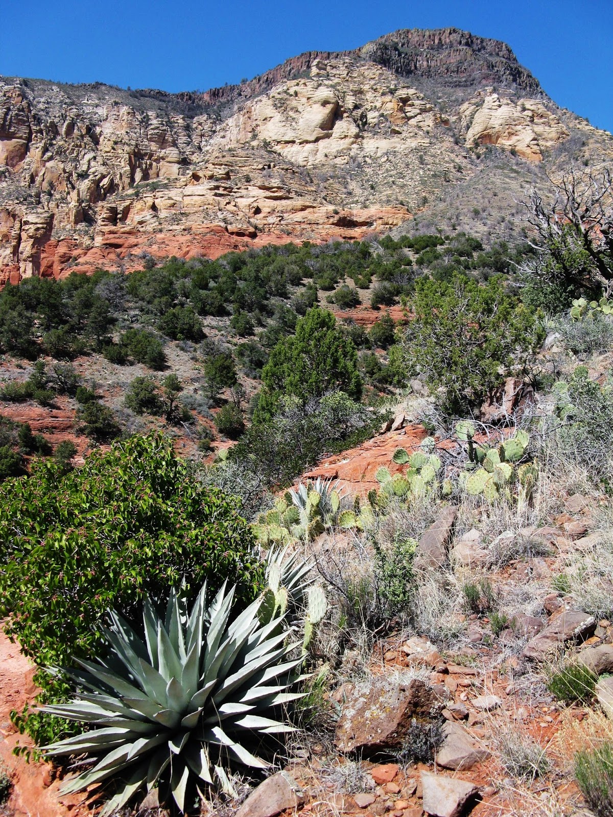
Which was fine, as the surrounding
landscape provided all the art I needed. Red Rock Country, it is
called, and while red is well represented, most of the nicely carved
mesas, cliff, mountains, and buttes are more of an orange, combined
with the creamiest of beige, a combination strongly reminiscent of
orange creamsicles, one of my most favorite childhood summertime
treats. This got me to wondering whether they still exist, showing
how much time I spend in the ice cream aisle nowadays, but a
certified young person I met (from Seattle, no less) confirmed not
only that they did still exist but that they always would. Ah, youth!
The
rich green from the juniper
and pinon
pine forest on the lower slopes and
the lusty blue skies overhead
whip
the whole schema into shape. Again, Sedona does deserve its
reputation for beauty.
But
it’s a strange case: a National Park-quality environment with a
small city in the middle, a tourist city with an outdoor feel but not
exclusive to outdoor recreationists. One can just
enjoy
the beauty from behind a cold one at one of the outdoor cafes after
touring the shops, and many do.
Even
where there is no construction the
town center is very congested. While most of the
town is
privately
owned,
featuring
very
upscale residential
and commercial development,
the US
Forest
Service has a good hold on the perimeter and provides lots of hikes.
The
trailheads tend to be located down fancy residential streets,
with parking regulations
far
stricter
than
conventional Forest Service trailheads. The balancing act must
be
daunting.
As
is taking pictures of these extraordinary
views without
power
lines running through them.
I
headed up Oak Creek Canyon north of the town and grabbed an open site
at Bootlegger campground, a tiny site along the road with no water
for $18, possibly the worst campground value I’d ever had.
(Bootlegger
has since been
converted to day use only).
Obviously I was paying for location, a fact I reinforced by
pitching my tent and fleeing for the day.
My first hike was in
Boynton Canyon, which I chose mostly for the photo in the
Mountaineers 100 Hikes in Arizona book. I somehow missed the
bit about the first part of the hike running alongside a luxury
resort, one with ongoing construction work the day I was there. The
trail itself was actually in a wilderness area, making for the
noisiest wilderness area ever. A barbed wire fence marking the forest
service boundary directly abutted a wrought iron fence denoting
private property, and at one point I was looking right down onto a
condo roof, an iron parapet discouraging me from descending to kidnap
an heiress, closed-circuit cameras positioned to capture anyone
foolish enough to try. On the upside the construction did reflect
cliff-dwelling architecture and fit in rather nicely. The landscaping
not so much.
The
trail
passed
through
thin
woods along a dry creek before
emerging on to open
rock
and
a fine set of climactic
views.
Some easy rock scaling took
me to even better views, and lunch. The hike was not very demanding
so later
in
the
afternoon I took
on
the A.B. Young Trail, climbing
two miles and 2000 feet
elevation
up the canyon wall straight
out
of my campground.
Despite
a hazy afternoon sun it
was a fine place to see
Oak
Creek cutting
its
canyon out of the Mogollon
Rim. It
also allowed
my first
peek
at the San Francisco Peaks, Arizona's
highest mountains, still
covered
in snow.
I yearned
to
explore
them but that would have to wait a couple of months.
Atop
the A.B. Young Trail was the
East Pocket Lookout Tower, a
sign
at the bottom saying visitors welcome, two at a time. I climbed up
three flights of stairs and found the gate locked. A small sign was
posted upside down on the bottom of the top stair presumably with
instructions for opening the lock, but in order to read it I would
have had to raise my head face up under the stair and still need
to
read it upside down, like
kissing the damn Blarney Stone. I didn’t really care about being on
top of the lookout
tower.
Back
at the campground things had improved dramatically. Four women had
taken the site on one side of me, two women claimed the site on the
other side of me, four more took the spot across the road from me,
and a car came in late at night with two more women to claim the site
next to them. That made twelve women, not a man among them, in the
four sites closest to mine. Odds like that and a boy could get
himself kissed. Alas I was no longer a boy and pleased enough that
Melissa and Tracy from the next site invited me over to their fire.
They were from the greater Seattle area. Melissa lived in Duvall and
frequented Third Place Books in Lake Forest Park. Tracy lived 15
blocks away from my apartment in Ravenna and patronized Ravenna Third
Place.
It
also turned out that Melissa's aunt was the campground host at
Saddlebag Campground outside Yosemite whom I had chatted with about
the tribulations of working a campground that had been touted as
California's best by some travel magazine. Melissa had also been
there the previous summer and she and I have a laugh over her aunt’s
stress level at this too-popular campground. The two young women were
nice and I had a good time, though I had trouble finding my words, it
having been some time since I'd been in a social situation. I pulled
myself away after an hour or so to avoide making a nuisance of
myself.
Bootlegger
Campground sat
at a cold
5000 feet,
tucked deeply in the narrow canyon that
did
not see the sun for a couple of hours after sunrise. No
place to linger so I
headed out early to the
world-famous
West Fork Trail, another
notorious mob scene that
I
had
it
nearly to myself thanks
to my early
start. A
family of three trailing
somewhat behind me were the only people I saw all morning. The trail
was
delightful
with
a plethora of stream crossings which
I was able to negotiate and stay almost completely dry. There
were even some lingering
snow
patches where
the
trail dwindled
into the creek at its rather spectacular end point. On my way out I
saw plenty of people, including
Tracy and Melissa, in flip-flops! I could kick myself for not taking
their picture.
I
didn’t want to keep
paying $18 a night to camp in
the cold so
I relocated
about
15-miles to
3300
foot Deadhorse
Ranch State
Park,
where
the tent sites were spare, sandy, and surrounded by creosote. I spent
the day at
the other end of the park, in
a
lush
picnic
area alongside the Verde River, one
of the desert’s last free-flowing rivers. The
park is
part
of a 35-mile
stretch known as the Verde River Greenway, one of the last stands for
the Fremont Cottonwood. As
the
wind grew formidable
through
the day, I
hunkered down behind a tree to eat my lunch and saw ants blowing
across the sidewalk. That
was new.
I
set out to hike something
called the
marsh trail but never got there. I
had read that the
trail was ¾ mile long but missed
the fact that it began
1.5 miles from the trailhead.
I ended
up
in a partially abandoned pasture with lots
of downed cottonwoods, roaring
out what
words I
knew to
“Helter
Skelter” in
the teeth of the
howling wind. When
I got back
to the campground I
found I
was
the only tent camper left; the
two
other parties
fleeing
when
they found
their
tents
shredded. Mine
was intact
but the
inside was covered with
an inch of gritty red sand,
another
new one. The
wind was
still raising clouds of red dust inside
my tent so
I took
to my car, the first time in months that weather
drove
me to the
discomforts of my
sub-compact
shelter.
I
commuted to Sedona for a few more hikes. The Wilson Mountain Trail
had great views early on but the splendor diminished after the first
couple of miles. Mogollon Rim and San Francisco Peaks looked fine in
the distance but Wilson Mountain itself had suffered a lot of fire
damage, great for the long-term health of the forest I know, but
being a single organism myself, I find it dispiriting.
I
was also getting frustrated that my hikes were not getting me to
places that matched the views available from the main roads. I had to
start puzzling out the elaborate neighborhood trail system and its
restrictive parking access. I picked one that sounded good but found
a trailhead with only twelve parking spaces, all filled but the
handicapped space, overflow parking strictly prohibited. So back into
Saturday traffic, retreating to Oak Creek to wait out the midday heat
reading in dappled sunlight, accumulating the gumption to go back out
and take on Sedona's streets.
At
my next trailhead I met some people who had been in town for three
weeks and had begun to figure things out. They told me of a trailhead
with more spacious parking that had a one mile connector trail to the
trail I had wanted to do. And from there, the Jordan Trailhead, I
finally nailed it: a four-hour delight ending in late afternoon light
leaving me feeling that I had achieved a valuable Sedona thing. I
could have stayed longer and figured the whole place out but I
figured there was a lot of red rock out there with far fewer
complications. So I called it a week for Sedona. On to Zion!


No comments:
Post a Comment