December 26 seems to me to be the real beginning of the new year, and this one began nice and sunny. I decided to stay at Buckhorn Campground another night since the first night had been free. I sat and read in the peace and quiet and coots - more coots - nothing but coots. It seems I was not on Lake Havasu at all, but on Moovalya Lake, which is more like a wide canal than a reservoir. It sits behind Headgate Rock Dam and stores irrigation water for some 100,000 acres of the Colorado Indian River Reservation. The cabana I was camped in was connected to others and I was happy no one else was using them. I imagined a summer day with large families and fighting kids and maybe a boom box blaring, thinking I’d get little reading done. If I’d only known…
This 10-mile-long, 400-foot wide “lake” is known as the Parker Strip, a notorious attraction for party-time speed boating - part NASCAR, part Mardi Gras someone once said - a highway with no lanes, no directions, no speed limits, and plenty of bars. It was once known as Red River for all the accidents, and though the Chamber of Commerce claimed it was much safer now, six people were killed in three separate boat accidents in 2003 alone. I have been unable to ascertain whether this was a particularly bad or simply typical year. Local government is hesitant to publicize the danger or crack down on behavior that brings an estimated $100 million into the local economy. Noisy families would have been the least of my problems.
Sunrise comes late here on the western border of the time zone. The sun didn’t break the low cliffs around my campground until nearly 8:30 AM, when light finally shone on the red clay outcrop across the reservoir. Reflections covered the entire narrow width in swirling impressionisms in colors those painters would never have used, though a small motorboat of white and red stopped to fish at the base of the rock did add a touch of pastel. It was Saturday, that’s why those fishing boats were on, Ok, I’ll call it the river. Some people apparently do work here in Southwest Arizona, and have Saturday off. I experienced an odd juxtaposition: reading peacefully in the sun, not knowing where I would be sleeping that night.
 |
| Moovalya Lake |
 |
| Moovalya Lake |
The holiday over, the highway was back to business though still quiet in late December. I strolled a trail along the highway at the Bill Williams National Wildlife Refuge, some fishing access and interpretive signs for the nature lovers. I saw a Clark’s grebe, some elusive goldeneyes, and coots up the kazoo. Bill Williams River runs its final 9 miles through the largest remaining cottonwood/willow riparian area left in the lower Colorado basin. The refuge is home to 34 butterfly species, 11 of which live only here, though they were once common throughout the lower Colorado. Naturally fecund Fremont cottonwoods rely on spring floods to deposit silt and seeds on the terraces above the river, but the dams have all but eliminated these floods along most of the Colorado.
 |
| Bill Williams National Wildlife Refuge |
 |
| Bill Williams National Wildlife Refuge |
Parker Dam, completed in 1938, forms Lake Havasu, ground zero for emptying out the Colorado River. The Metropolitan Water District of Southern California deploys 9 pumps feeding pipes 10 feet around to lift water 281 feet up from Lake Havasu and then down a series of tunnels, pumps, canals, and siphons known collectively as the California Water Aqueduct, 240 miles to Riverside County. Then there is the Central Arizona Project, the most expensive aqueduct project in US history, which uses 6 pumps and 12-foot pipes to raise water 825 feet through a tunnel in Buckeye Mountain, at which point gravity send 1.5 million acre feet of water per year to Maricopa, Pinal, and Pima Counties - Phoenix, Tucson and environs. What remains is parceled out of Lake Havasu and down the Colorado to Imperial Dam for dispersal to the agricultural lands of southern Arizona and California. As a side-effect, Lake Havasu provides recreation for millions, as well a huge winter residence influx. Native flora, fauna, and processes get the scraps. The poor and starving will typically accept the scraps.
“And I cry every time that you slip in one more dime”
Yes. I had James Taylor’s "Hey Mister That’s Me Up on the Jukebox” in my head. Not a good sign. It occurred to me, what with James Taylor in my head for days, and listening mostly to Belle and Sebastian, Sufjan Stevens and Joanna Newsome but not Lynyrd Skynyrd, Santana or even the Grateful Dead, that I was a real wimp. Six months out on the road had brought out not a tough road guy but the alienated adolescent I never really got to be. I’m not sure the style even existed back then. I think I would have liked it. I conjured up a sketch of a novel, with a star high school basketball player who just happens to be brave enough to hang with the Belle and Sebastian kids and good enough on the court to get away with it, maybe with the intervention of a - what? - hip-brother-fan with the people who wanted to ostracize him if not beat him pulpy. I don’t often conjure up sketches for novels.
A half hour out of the Parker Strip comes another Arizona phenomenon: Lake Havasu City, a community created out of the desert in the 1960s by a lawn mower magnate with a dream of manufacturing outboard motors. To publicize his new city he bought London Bridge, had it shipped to the US in some 10,000 pieces, then put it back together and ran a little water under it. The guide books were all over this one so I stopped to check it out. Whatever its historic significance, it’s an underwhelming bridge. It carries traffic so walking along the top is not very evocative. Beneath it was tourist Anglophilia. I was glad I didn’t have to pay for parking.
Lake Mead National Recreation Area
North from Lake Havasu, west briefly into California past Needles, and then north back into Arizona, with Nevada just across the Colorado, the hotels of Bullhead City serving the casinos of Laughlin Nevada. The Colorado is the boundary between Arizona and California and then Nevada, and crossing back and forth entails constant changes in time zone, a common enough occurrence for many people but a bit disorienting for me. Nevada, like California, is Pacific Standard Time while Arizona is Central Standard Time and to make matters more confusing does not follow Daylight Savings Time. A few more miles into Lake Mead National Recreational Area and a campsite on the shores of Lake Mohave, a long skinny finger of a reservoir backed up by Davis Dam. Lake Mead NRA does not take a position on time, deferring to the states. It was terribly windy and much colder than what I‘d been enjoying, but good enough, and the next day I passed the nothing of Searchlight Nevada and on to Lake Mead itself.
Lake Mead, created by the legendary Hoover Dam, is the largest reservoir in the US. The campground was cheap and mostly empty, with running water and flush toilets, so I decided to just stay for a while and take advantage of the nearby urban amenities. Clearly I needed to recharge my batteries. The campground was 10 minutes from groceries and a small library in Boulder City. Home development (and a couple of casinos) extend right up to the NRA border. Given Nevada's foreclosure rate, I wondered if maybe we'd be able to rent McMansions on future visits.
It was quite lovely sitting in the sun. This is a good spot - in winter. The crowds come in the summer and lord it must be hot. It is a summer boating attraction, but a seven year drought had brought the lake level to historic lows, and many boat ramps hung dry - hundreds of feet from the lake. A nice little group of Gambel Quail visited my campsite, pecking around the creosote. “Long a prized game bird in Arizona” said the brochure, but they looked so small I wondered what might be left to eat after you shot it. As it happens I know a quail hunter and posed the question to him the next time I had access to email. He informed me that a few birds can make a nice plate. You’re not stocking up the freezer for winter.
Henderson is a suburb of Las Vegas and close readers will recall I’d been there once before, out for groceries from Mojave Desert National Preserve many miles ago. I had been using state maps, which tend to disguise how close together some of these things really are. Henderson has every chain store in creation, and since this included an REI right across the (nearly uncrossable) street from a Whole Foods, with a pretty good library a few blocks away, I began commuting from my campground, my drive overlooking an ominous and very polluted Las Vegas strip.
I decided to take advantage of the strip malls and went shopping for a new camera in a half-dozen chains, where customer service was taking on the recession with a heightened sense of lethargy. What I wanted to do was simply buy another copy of the camera I was already using, the Canon 790A should anybody care. I had grown to like it but I was also beating it up pretty good so I wanted another one in the likely event mine gave out on me in some gorgeous spot nowhere near a camera shop.
This struck me as a modest enough wish, but it proved futile. Despite having bought the camera new seven months earlier, the model was nowhere to be found. Target, Kits, Walmart, Electric Circuit (or whatever), Sears - all carried lots of portable cameras including Canons, but no one had mine. No one expected it in again. The model was gone, obsolete. The alleged replacement model was simply not the same thing; the entire line had been more or less ditched, for newer models, newer gimmicks. The very notion of buying a product, using it for its lifespan, and then replacing it with the same model had become obsolete. I was no longer part of any discernible market, at least as long as I could keep myself out of the health care market. I was obsolete.
-------
I hadn’t been doing much outdoor exploring but finally I set out on a trail leading from the campground onto a spare landscape of creosote and rocks. The trail didn’t really do anything but wind through the desert, rocks lining the way. Possibly this provided easier tread, but it mostly served as a jump-start, a trail obviously not necessary for this kind of terrain. Far below me an anomalous creek ran through riparian greenery so I worked down crumbly formations, one huge shelf of barely consolidated alluvium collapsing into enormous orange boulders. Thickets of I’m not sure what at the bottom blocked any easy access to the creek. So I followed what I took to be a coyote trail upstream, imagining it ending at a pack of cornered coyotes poised to attack.


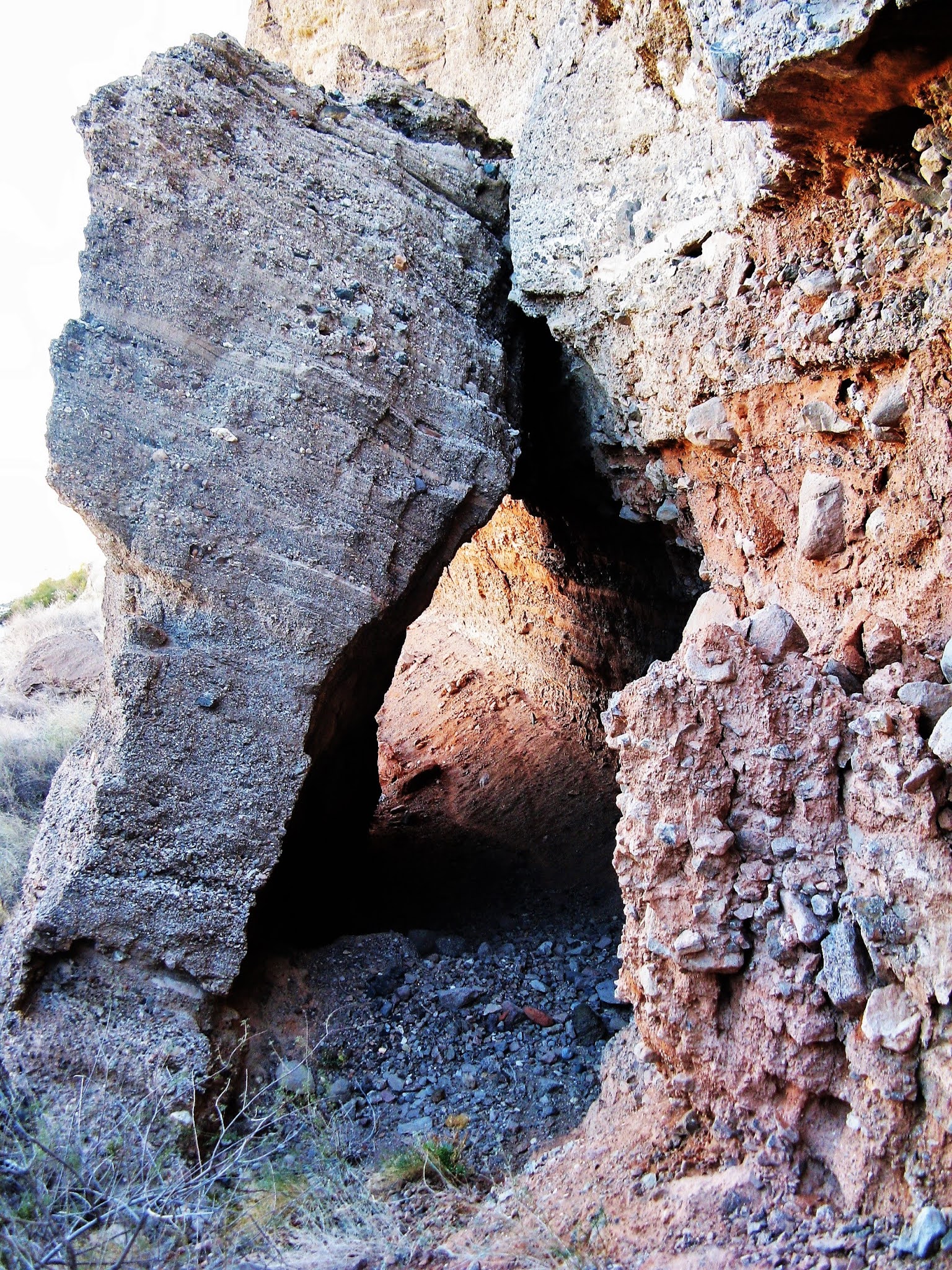
Then across the highway bridge to where an amusing “wetlands trailhead” sign was pitched into the dry rocks marking a dry rocky trail back down to the other side of the creek. Nice cattails and would you believe it - coots. A waterfall tumbled over a dam wall but I saw no sign of electrical generation. The water looked and smelled like runoff from a laundromat, and I cast a suspicious eye at the hotel upstream. There were no interpretive signs, just one warning of high water. The whole place was puzzling. Eight years later I returned and spent some time getting a handle on this creek, known as Las Vegas Wash. https://iwentwalkiing.blogspot.com/2020/06/chasing-water-lake-mead-national.html


 |
| Las Vegas Wash |

North Shore Road
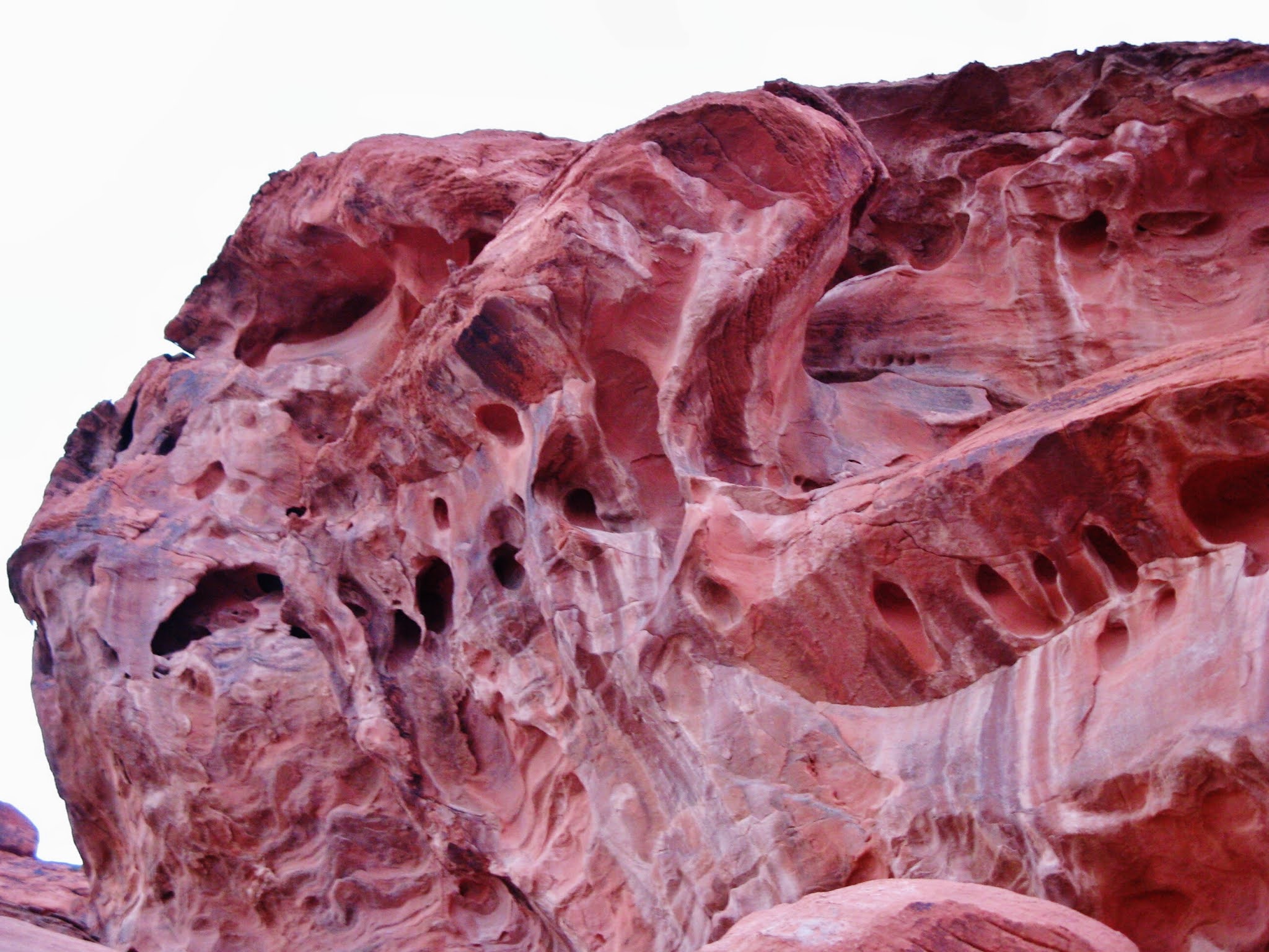
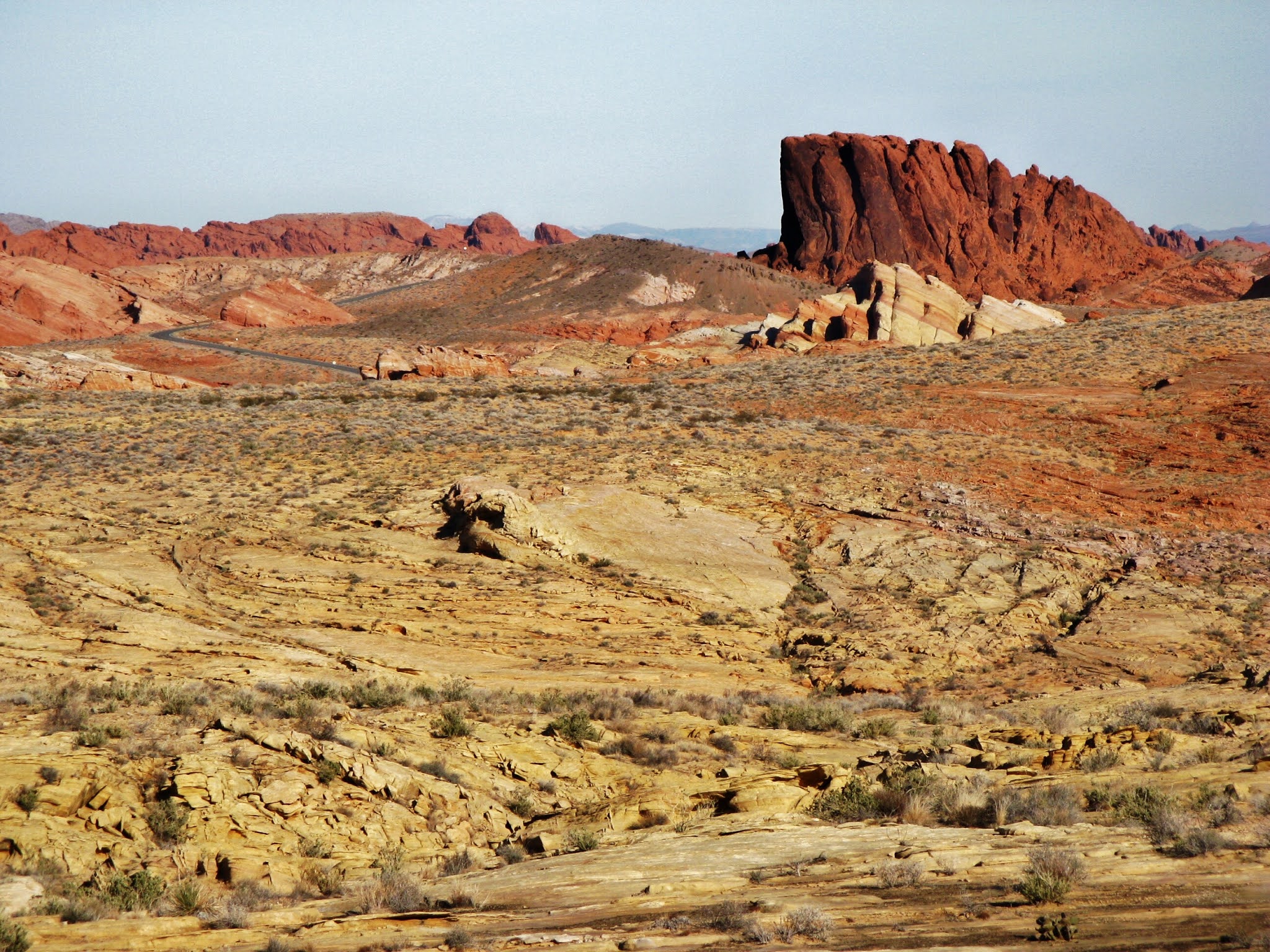
I found a more enchanting landscape driving along the North Shore road on my way to Valley of Fire State Park. Rising just off the road were eye-catching, sharp-edged, steeply angular formations, the likes of which I had never seen. Plus the strangest mountain face since Convict Canyon in the Sierras. multi-colored but with more light pastels than prevailing reds and browns. The shapes and colors seemed discordant, like an artist not quite getting the aesthetics they were striving for. Intriguing but not yet cohering. None of this was marked on the park map or mentioned on the website. No signs, no trails, no real acknowledgment, but easy roadside parking and off-trail exploring. Quite dramatic though oddly you don’t see many photos of it. Eventually I learned what I was admiring was part of the Gale Hills and the sharp-edged angular formations called hogbacks. – my first exposure to such a thing – and the colors… Sparse vegetation reveals seemingly incongruent formations, leading me to wonder what might be hiding on familiar slopes covered with vegetation.

 |
| Hogbacks |


Valley of Fire State Park
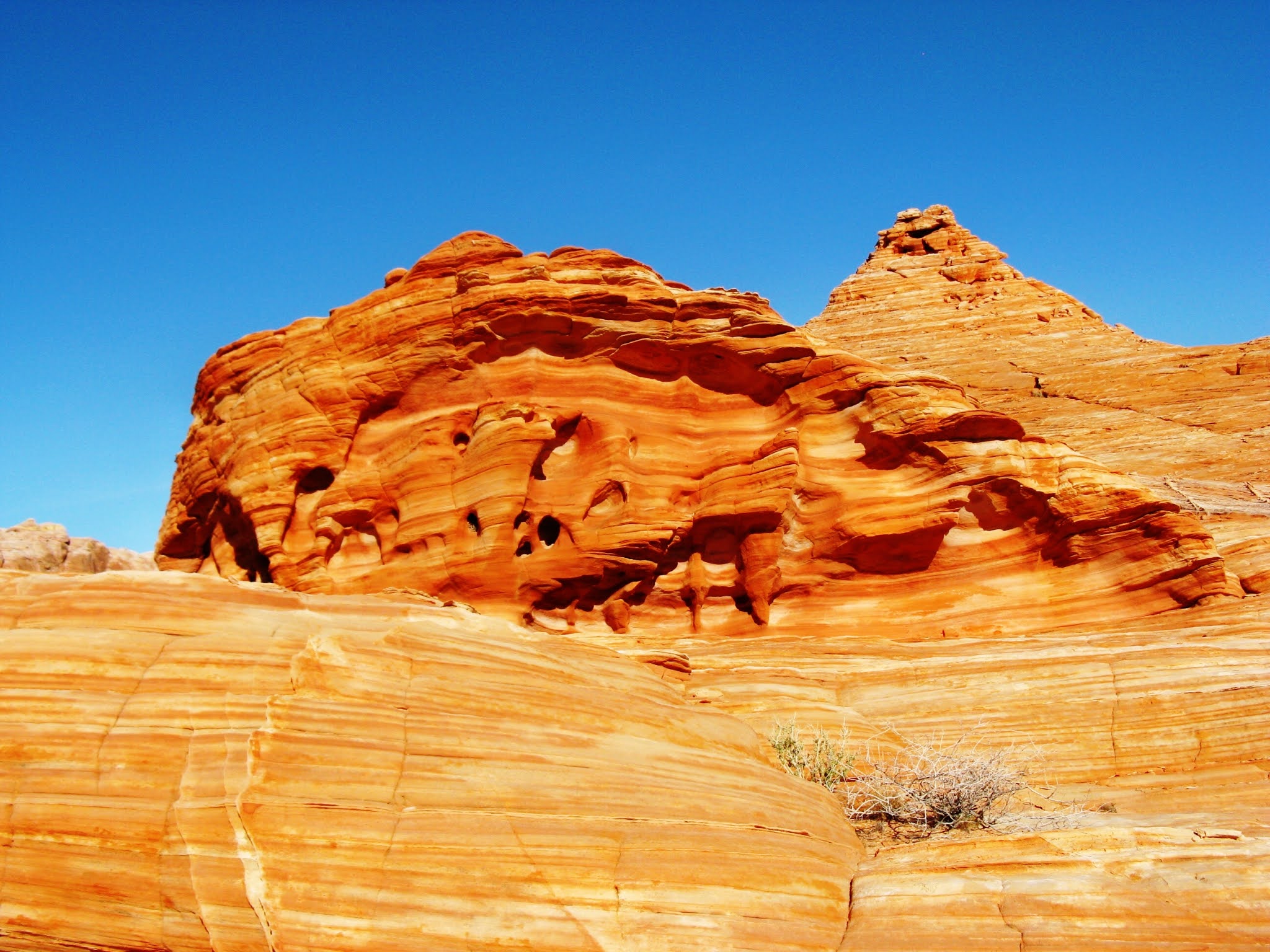
Next stop was the Redstone Dune Trail, a half-mile loop and one of the NRA’s few official trails. This was my introduction to Aztec Sandstone, at midday a bright orange/red rock eroding into evocative shapes. If I’d known it was mostly a warm-up for Valley of Fire State Park I might have skipped it and gotten a better campsite. I barely got one at all. It was New Year’s Eve and the place was filled up solid. I would not be having any mystical experiences. I was just hoping I’d get some sleep.
 |
| Redstone Dune Trail |
 |
| Redstone Dune Trail |
 |
| Valley of Fire State Park |


New Year’s Eve passed quietly enough. I woke up to the surrounding lumps of red sandstone that, lacking sunlight or dusk, looked like so many piles of purple vomit. I was glad I hadn’t been drinking the night before. Otherwise the morning was lovely. I’d forsaken the idea of racing out and catching the morning light at White Domes. My soul was speaking and it was saying it really didn’t want to race out doing anything. It wanted to sit in the sun and read, maybe write. A little reflection felt good, even though I felt I really hadn’t done anything, by which I knew I meant I hadn’t gone on any long day hikes. Just lots of jumping and puttering around these beautiful spots all along the highways, places that would be destinations except you’re already there.


Red Rock Canyon
Red Rock Canyon, a Bureau of Land Management Conservation Area, is said to be 15-minutes from Las Vegas. In fact, housing developments run flush against the park border, though many of these residences appeared empty when I drove by. The campground is tucked into a little basin and once you descended you could have been a million miles from anywhere, at least until you climbed a mountain trail and could look out onto the big polluted strip. Despite the urban proximity, Red Rock is above all a climbers magnet - one of the top-5 climbing destinations in the US - and for the first time in months I was in a campground filled with backpacking tents, camp stoves, and head lanterns. It was nice to be back with my people.
Good trails slice through some nice mountains whose walls seem to be talking, but this is only the climbers. Sometimes you spot the source of the voices, more often you never do. That morning I witnessed a helicopter coming in to pluck a broken-boned climber from the base of a cliff. I was on the White Rock trail, a six-mile loop plus a two mile side trip to the Keystone Intrusion, “one of the best examples of thrust faulting there is” according to the park brochure. But I couldn't quite figure out what I was looking at; somehow it eluded me.
Still, it was as lovely a hike as I'd taken in some time. With only an 800’ elevation gain, the trail makes a distinct ecological transition from Mojave Desert (a light sprinkling of Joshua Trees) to Basin and Range, pinyon pine and western juniper a real delight after all the creosote I’d been encountering. Some madrona, some beavertail cactus to keep you on your toes, some snow patches, even some accumulation in the deep shade. The ice on the trail was conveniently covered by blown red sand. Oops, not that patch! All surrounded by calico cliffs, with White Rock Hills and Turtlehead Mountain providing mountainous backdrop.


Halfway along the trail gives way to reverted jeep track, then real jeep track, then, hey, an oncoming jeep. The last two miles revert to open Mojave, rich Mojave ground cover, with Mojave Yucca and Buckhorn Cholla rising above a thick sea of dormant brush, auguring a rambunctious spring, in front of the spellbinding White Rock cliffs.
Sunday morning a half hike half boulder hop up Icebox Canyon, over and around a nice little creek, and you don’t see a lot of those out here. Narrow, steep, dark, and icy. But it was a warm day. For non-climbers the trail ends at a dramatic canyon waterfall, a thin line of water coming down.

Then an afternoon scramble to the summit of the Calico Hills, a curiously-colored exposure in its own right, and quite the color extravaganza when juxtaposed to the Aztec Sandstone and the streamlined sedimentary swirls of White Rock. I stumbled upon some kind of photo shoot on the rocks, brassieres being refastened just as I arrived. I did have pleasant chats with three different women in the course of the afternoon. That’s a lot.


Colorado Desert So Long
My final night in western Arizona fairly well summed up the entire experience. Back in Lake Havasu City I set up camp in a free BLM wash, a decent place with RVs scattered about the creosote, "seniors" out enjoying cocktail hour in the warm twilight. Safe enough, right? The only wild card was a nearby tent, occupants not in sight. Shortly after dark they returned: on foot! Three people: a youngish man and woman and a young teenager - this by their voices; I never saw them. They did not speak as if they were a nuclear family, but rather nomads. They cursed a lot and were quite loud but seemed generally harmless and they did quiet down cooking vegetables over a fire as the evening progressed. Meanwhile several cars came in late evening and one pulled in fairly close to me, quietly, and just parked.
Well, I figured, just sleeping in the car. But sometime around midnight, a car door opened followed by footsteps on the gravel very near my tent - how near was hard to tell because the ground surface was hard and rocky and foodsteps resound loudly. Then another car door opened and a woman's hard voice yelled out "Give me back my lighter you goddamn rapist!" The footsteps stopped and the walker seemed to settle down in the nearby wash and proceed to hack out his lungs for a good long time. I was a bit tense but remarkably fell back to sleep only to be reawakened - I don’t know what time it was now - by the car driving slowly by and the driver yelling at him and everybody else, calling him a child molester, demanding her camping gear back, and who knows what else. She drove back and forth a few times and then left. He was still lying somewhere nearby.
All this commotion had my little tent family all rousted and, judging by their tone, stressed out as they spent some time recapping the situation. The older guy - not that old and despite the profanity not that hard I didn’t think - started harassing the prone hacker (actually the young kid did some hacking as well - the whole place sounded like a tubercular ward). I couldn't really tell if they were involved with these people or not, but the youngish man called out to the alleged rapist child molester that he better get out of there or else he was going to beat his ass and if he saw him in town he was going to beat his ass. The prone guy responded with a very rough sounding voice, but not a belligerent one, leading me to think the guy doing the yelling must have known something about him or else he wouldn’t be threatening to beat up a total stranger. At any rate, the guy got up and walked past me again and more or less disappeared into the night. The three tenters were actually sort of cute as they talked themselves down from all the excitement, reworking the scene, bad-mouthing the participants, and finally quieting. I too calmed down enough to sleep till dawn when damn straight I picked up my tent and got the hell out of there. So much for camping in a free wash.
So breakfast in the Walmart parking lot, coffee for the road, and back south toward Yuma, feeling gloomy at the prospect of tracking down a car dealer, getting my car fixed, and finding a place to stay, depressed by the thought of being back in Yuma at all. The highway at Quartzsite was an RV hellhole – the gem show and swap meet now underway - and as I sat in traffic I spotted an angel of the Lord in the guise of a sign for Interstate 10. The meaning was clear. I did not have to face Yuma. I could get on the freeway and head east toward Phoenix. Out of the lower Colorado basin. Into the Upper Sonoran desert.
No comments:
Post a Comment