I
spent eight nights at Big Bend National Park in February 2009. I sent out an email report at the time and this post is based largely on that. I have subsequently returned to Big Bend
twice, in 2018 and 2019, and have included a few pictures, though no
text, from those visits.
2/08/09
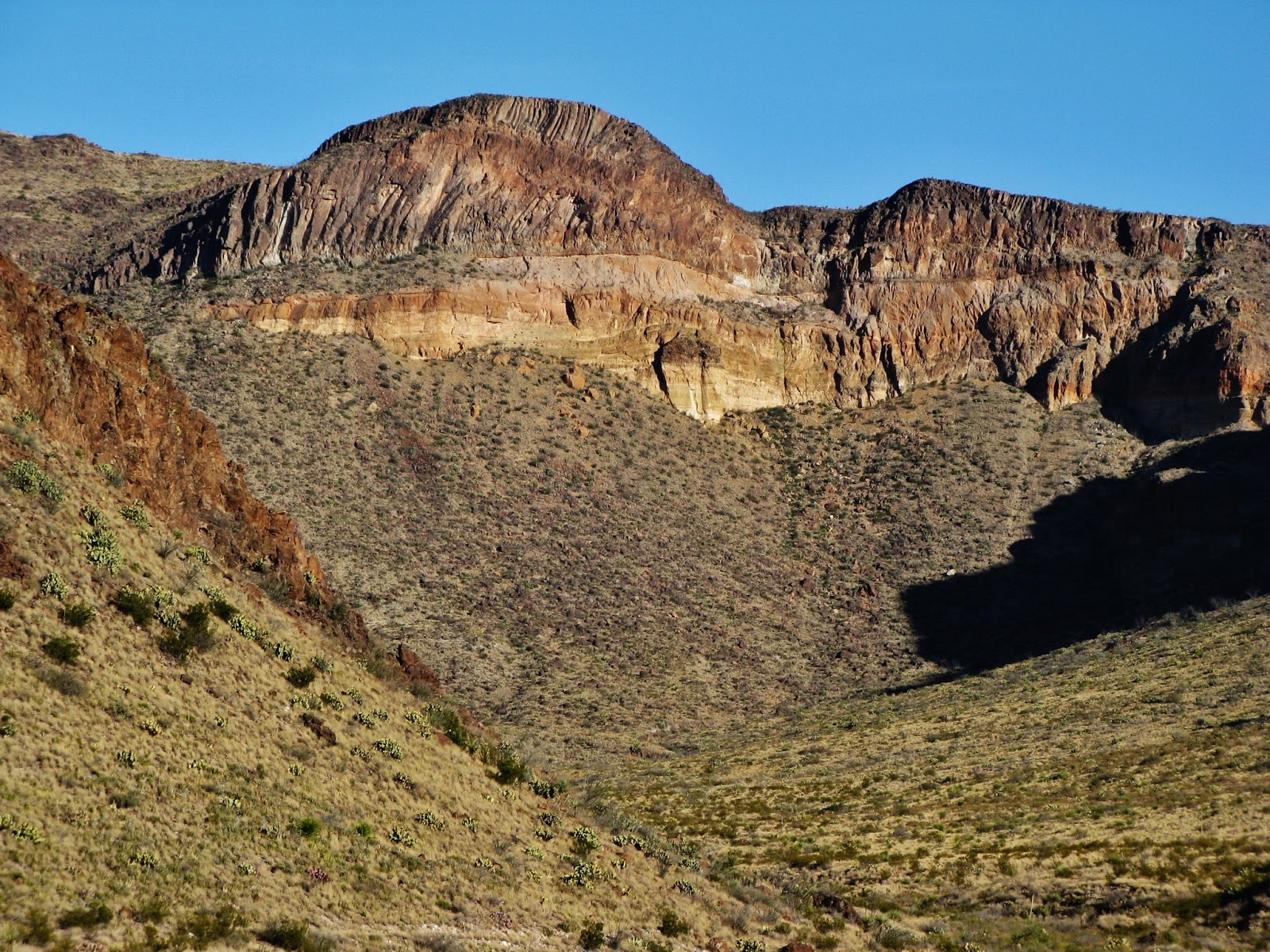
Big Bend National Park is located in the southwest corner of Texas along 118 miles of the border with Mexico, delineated the entire length by the Rio Grande. At 800,000 acres it is one of the country’s larger national parks – the eighth largest not counting the behemoths of Alaska. Beyond the river corridor the land is comprised almost entirely of Chihuahuan desert, punctuated by countless rugged hills, buttes, mesas, and small mountains, all fostering austere desert ecosystems.
Big Bend National Park is located in the southwest corner of Texas along 118 miles of the border with Mexico, delineated the entire length by the Rio Grande. At 800,000 acres it is one of the country’s larger national parks – the eighth largest not counting the behemoths of Alaska. Beyond the river corridor the land is comprised almost entirely of Chihuahuan desert, punctuated by countless rugged hills, buttes, mesas, and small mountains, all fostering austere desert ecosystems.
The
centerpiece of the park, though, is the Chisos Mountain Range, twenty
miles of jagged peaks eroded from
volcanic eruptions 40-60 million year ago. The Chisos are a sky
island, rising high enough
above the desert to generate its own ecosystem: an 800-acre
temperate forest of oak, juniper, and the rare and beautiful Texas
madrona. At the highest elevations some Ponderosa pine and Douglas
fir hang on, relics from the last ice age. Desert plants including
cactus are encroaching, an unlikely balance hinging on the direction
of future climate developments.
The
Chisos Basin campground sits at 5,400 feet, almost entirely encircled
by a cluster of the highest and most rugged of the peaks. Casa Grande
(7325’) is the basin’s visual centerpiece; Emory
Peak (7,825’) the tallest; Vernon Bailey Peak, just 6670’, but
seemingly as wide as it is tall, its entire above-basin bulk fully
exposed. The basin is in a transition zone of high grassland and
brush, allowing open views to these imposing masses. It is one swell
place to watch the setting sun set fire to the rock.
 |
| Casa Grande |

 |
| Vernon Bailey Peak |
The
Chisos are popular year round but are particularly valuable in the
hotter months when daytime temperatures remain 10-20 degrees cooler
in the mountains than on the desert floor. I worried a bit about what
this differential would mean for winter lows but oddly the Chiso
Basin was warmer at night than the campground along the Rio Grande at
1800 feet. This seems to result from a combination of the bare Chisos
rock absorbing and maintaining the daytime sun, and the effect of
cooler air sinking into the lower river valley. On the other hand the
rising morning sun got stuck behind Casa Grande and didn't hit the
campground until after 9:30 AM.
A
network of trails makes for good mountain hiking. Some three dozen
backcountry sites are heavily utilized. I day hiked to Emory Peak, at
7,832' the tallest peak in the park and the eighth tallest in Texas.
It’s 10.5 miles round trip
through both forest and exposed mountainside, culminating in a
25-foot rock scramble, challenging for non-climbers, especially on
the way back down. The
ranger station records dozens of cougar sightings a year in the
Chisos, but none by me thank you. Black bears have
also recently reintroduced themselves from Mexico, after being driven
out fifty years earlier. Big cliffs, broad views over the
desert; it was really nice to be back in the mountains.

Javalinas
A
pack of javalinas was browsing the campground when I arrived. I had
seen them
once
on
a nature show and had been
amazed
to
learn such an animal roamed wild in these United States. Yet here
they were in my campground in broad daylight, casually browsing the
flora. Javalinas are famously “not
pigs”, something their human spokespersons must continually
emphasize because they sure do look like pigs. They are, in fact,
collared peccaries, genetically distinct from pigs for millions of
years. They are wild animals in the Southwest,
somewhat on the order of deer in that they roam around
browsing. They are primarily vegetarian and love prickly pear cactus,
spines and all, though they’ll also scoff up a bird’s egg or two
should they come upon them.
 |
| Javalina |
 |
| Javalina |
They
weigh 40-60 pounds and travel in herds of 10-20, which is a lot of
collared peccarie (think pig) to be running around a campground,
particularly since they have no deer etiquette. They don’t spook
easy and in fact seem rather surly. They have poor vision (but a
great sense of smell) and rather than move away from you they will
come closer just to get a better look. They have very sharp teeth and
hooves and if you leave the family dog tied up at the campsite and
things go the wrong way they might give it a good and even fatal
thrashing. In their minds, it’s self-defense.
Right
off the campground host gave me a tip. If you want them to move just
throw a handful of pebbles a few feet behind them. They’ll scamper.
Don’t hit them, because then they’ll stay put. I tried this and
it worked perfectly.
People
complain about their smell but I didn’t find them that bad. They’re
a bit gamey, but not foul. Of course I couldn't always claim the high
ground on that issue myself. But lying in my tent one night at
nearby Fort Davis State Park as
a dozen or so came migrating through my site, milling
about making weird porcine snorts, them being near sighted and ornery
and all, that was a bit disconcerting
The
truth is javalinas jostled let’s say my commitment to the
Endangered Species Act. This is odd because they aren’t threatened
much less endangered. They just make me wonder why they aren’t -
they seem too preposterous to be running around freely like this. In
fact the Big Bend javalina were being hunted toward extinction before
the establishment of the national park in 1944. Since then it has
been protected like any other species and is “now recognized to be
an integral part of the Chihuahuan desert ecosystem, an animal worthy
of study.”
But
what I wonder is this: this is cougar country. Cougar prey on
javalina, which seem to lack the speed and agility of deer. I don’t
understand why a cougar wouldn’t just stalk a band of javalina and
just take one every time it got hungry until there were no more
javalina and it had to go back to chasing deer. Maybe they don’t
taste so hot? There must be a reason, otherwise they’d be
endangered and I’d have to pull up my socks and support the
porkers.
The
Rio Grande
The
defining characteristic of Big Bend National Park is of course the
Rio Grande. Most of the 187 miles of riverfront can be accessed only
on very rough jeep roads or by boat on the river itself. For the rest
of us two paved roads lead to dramatic canyons the Rio Grande has cut
through enormous cliffs along the border. The canyons are at opposite
ends of the park: Santa Elena on the west where the river runs into
the park, Bocquillas Canyon on the east, where it leaves.
The
desert drive to Bocquillas Canyon can be leaden at midday. It
improves toward the end with views of the enormous Sierra
del Carmen range, the northernmost extension of Mexico’s Sierra
Madre Oriental. 45 miles long and up to 8,920 feet high, its pink
limestone escarpment towers over Big Bend’s Sierra Del Caballa
Muerto, some 7000’ above this portion of desert floor. It’s a
fabulous backdrop but it’s in Mexico and Big Bend visitors can’t
get there. Mexicans can barely get there. The Sierra del Carmen is a
very isolated range.
 |
| Sierra del Carmen |
 |
| Sierra del Carmen |
At
1,800 feet elevation this corner of the park is one of the driest and
hottest parts of the Cihuahuan desert. Rio Grande Village gets 4-6”
rain/year, most of it in summer thunderstorms. While nighttime lows
may be lower than the Chisos, evening temperatures remain comfortable
and the campground draws a good winter crowd. It
has heavy tree coverage so regaining those mountain views
requires a climb onto some of the surrounding foothills. In
compensation it has more bird action, at least in February. A raven
with an arsenal of sound
effects was making a racket
on the telephone poll. A cardinal tried to
raid my kitchen. And – finally! - some roadrunners, two of them
sitting in the sun, wings raised and spread, exposing their butts to
the sun. This is how they warm up in the morning. The smaller one
seemed insecure and kept looking over his shoulder, like a freshman
in the locker room.
The
Rio Grande of course has enormous geopolitical significance, the thin
line holding back the vast poverty of the rest of the western
hemisphere. The US government closed the border at Big Bend in 2002,
and signs warned visitors not to cross into Mexico as reentry is
illegal and could cost $5000 and/or a year in jail. Other signs
warned against buying goods from anyone coming across the river, as
the goods may be seized as contraband and the seller fined and
deported at the nearest border station, over 100 miles away.
I took the short walk into Bocquillas Canyon - 1,200 foot limestone canyon walls, eroding into a fine sand. It is not much of a physical border, but it is powerful and poignant. Sure enough along the beach were some walking sticks and jewelry with a price sheet and a jam jar for payment. No one was in sight but I could just feel the eyes - of the merchant, of the border patrol? The tension brought an odd dissonance to an otherwise placid scene. I spotted a canoe on the Mexican bank and assumed it belonged to the merchant, and in fact I came back a couple of days later in the late afternoon and saw the guy rowing across the river. A group of boys on burros waited for him on the Mexican side.
 |
| souvenirs |
I wasn't sure of the etiquette or, frankly, the safety of the situation, but I continued my slow saunter in his direction and when I got to within earshot he called out "Don't worry amigo I am not going to hurt anyone. I am just selling souvenirs." So I asked him "How's business", and he said "slow", as I would think it would be on an empty beach with signs warning visitors against buying his goods. I had seen another collection of very similar looking crafts further up the beach and he said they belonged to someone else. Competition! I wanted to ask him if anyone buys anything, whether there is any enforcement on this beach, if he ever gets caught and deported, if people took stuff without paying for them and if he and his boys had any means for dealing with that. But I didn't ask any of this. I just went along my walk through the light and the sand while he returned across the river for home.
 |
| Boquillas Canyon |
 |
| US-Mexico |
 |
| Rio Grande |

 |
| Rio Grande |
Ironically,
it is Mexican water providing the border so important to the US.
While the Rio Grande rises in the Colorado Rockies, the farms and
communities of Colorado and New Mexico suck it dry, so by the time
the river gets to southern New Mexico it is barely a collage of
drifting puddles. It rarely exists at all past El Paso. The water
doing border duty comes from Mexico’s Rio Conchos, flowing down
from the western Sierra Madres and joining the Rio Grande at Presidio
some 100 river miles outside the park.
This
is the result of a 1944 treaty in which the US allows some water from
the Colorado River to flow into Mexico while Mexico guarantees a
certain amount of Rio Conches water to replenish the Rio Grande.
Normally supplies are tight, but in September 2008 the Rio Conches
flooded and the Rio Grande ripped through Big Bend, damaging the
campground and the nature trail. It was the first flood in 15 years
and the biggest one on record.
Santa
Elena Canyon
The
drive to the Santa Elena Canyon at the other end of the park is more
exciting. It even has a name: The Ross Maxwell Scenic Drive. Terrific
roadside volcanic mountains such as Goat Mountain, Cerro Castelon,
and Burro Mesa rise 1,000-2,000 feet above. With little rainfall to
hasten erosion and sparse plant coverage, the individual lava flows
and ash deposits can be distinctly identified and traced. Some
interpretive signs pitch in. Bluebonnets in season.
 |
| Goat Mountain |
 |
| Goat Mountain |
 |
| Cerro Castelon |
 |
| Cerro Castelon |
 |
| Burro Mesa |
 |
| Burro Mesa |
 |
| Bluebonnets |
Santa
Elena is even more daunting than Boquillas, in part because it faces
the road straight on, the river emerging through a dark defile of a
mountain wall rising 1500 feet high on either side. A rough trail
extends about a mile into the canyon and I spent an hour and a half
perusing it. It is darker than Boquillas, positioned to get less sun.
The rock looked both darker and harder, even though the books says
it’s the same rock. The walls have spectacularly delineated
sedimentary layers and huge boulders crowd the canyon. A tempting
light shines at the end of the tunnel but for the pedestrian it
remains only a glimpse.
 | |
| Santa Elena |
 |
| Santa Elena Canyon |
 |
| Stratification |
For
all its import Rio Grande is just a river, and the first freely
running river I'd seen in months. At one point a large sand bar
directed much of the flow over toward the US side, creating a narrow
rapid channel complete with riffles and whirlpools running along a
bank rich with vegetation. I sat there for a sweet while, coming as
close as I come to meditation. Oh, my heart cries out for rivers.
 |
| Narrow Channel |
But
high jinks, there were high jinks. I was hopping about on the
enormous boulders lining the river and at one point I came across
some mud I needed to cross. The mud had footprints so I assumed it
was OK, that is if I thought about it at all, but when I jumped down
my left leg immediately sunk to my thigh. The mud kept sucking for
more but luckily my right leg had hit more solid ground and held,
buckling to the knee, and I was able to dredge my other leg out,
along with about 10 pounds of mud. Quicksand! I suppose I knew it
really existed, but I associate it with old TV shows like Lassie or
Bonanza, needing a dramatic rescue or some frontier justice. Yet here
it is, alongside a one-mile National Park trail. What an educational
trip.
Once
outside the canyon the river opens up onto sand bars and sandy
beaches. I sat on the beach in the afternoon and read for a while,
thoroughly alone, except for maybe the hidden eyes. No souvenir
merchants ply this strip. I thought of the Berlin Wall and the Iron
Curtain, borders once harshly defended that were no longer borders at
all, and how one can now go from Moldova to London by waving an ID.
And I thought of communities divided by new borders, the wall Israel
has built around Gaza and the fence my campground neighbor thinks
should be built along the entire Rio Grande. "It worked in San
Diego". I suggested the Texas desert might be too big for such a
fence but he said no, the money was there but Bush refused to do it -
"It's all politics" he concluded - fair enough I figured,
given we were a democracy, "and Obama sure won't do it."
Above
all I was struck by the significance of what was not there on
this warm sunny day. This is the only water around; the beach should
have been crowded with people swimming and basking, the
river a bevy of beach balls and rafts. But it was empty, save for the slow stream of tourists from the US side coming in for a quick view
of the canyon before going on to the rest of the park. This should be
an international park, and one day surely will be. But not in my
lifetime.
 |
| US-Mexico-US-Mexico |
Desert
Mountains
and river notwithstanding, Big Bend National Park is comprised
primarily of desert. This is the Chihuahuan Desert, the fourth and
final one along my southwest journey. The Chihuahuan is the largest
of the North American deserts, though as with the Sonoran Desert,
most of it is found in Mexico. Unlike in the Mojave or Sonoran
deserts, no dominant indicator plant - no Joshua Tree, no Saguaro -
presides over the Chihuahuan landscape. The tallest plant is
typically the familiar ocotillo, so thin and whip-like here in winter
you hardly notice them (unless you inadvertently grab a hold of one).
Here
the indicator plant, found throughout the Chihuahuan desert and
nowhere else, is the comparatively inconspicuous lechuguilla. It
grows a foot or two above the ground in bunches (basal rosettes) of
thick green shoots that culminate in points sharp enough to earn it
the colloquial name “shin-dagger”. They can reproduce clonally,
and sometimes render extensive areas impassable.
 |
| lechuguilla |
 |
| Lechuguilla |
Lechuguilla
is an agave, one of three agaves in Big Bend. A competing agave,
familiar from the Sonoran Desert, is the Havard agave. Its rosette is
taller and more expansive than the lechuguilla and has absolutely
vicious spines. It seems fairly easy to distinguish from the
lechuguilla but I kept getting stumped and couldn’t figure out why.
I was later relieved to learn that the third Big Bend agave is a
cross breed of the Havard agave and the lechuguilla; it looks like a
large lechuguilla or a small century plant. Well hell...
A few scattered agaves had skinny shoots reaching high into the air. Agaves, I would learn, bloom but once in their lifetime, waiting 10, 20, even 50 years (not 100, despite the sobriquet “century plant”) and then abruptly sending up a flower stalk 8 to 10 feet in just a few weeks. They bloom for a short period of time and then die, exhausted. Further complicating identification, neighboring yucca and sotol pull the same shooting stalk stunt. Dead stems of all these species litter the desert floor, their spines potently sharp.
 |
| Agave |
A few scattered agaves had skinny shoots reaching high into the air. Agaves, I would learn, bloom but once in their lifetime, waiting 10, 20, even 50 years (not 100, despite the sobriquet “century plant”) and then abruptly sending up a flower stalk 8 to 10 feet in just a few weeks. They bloom for a short period of time and then die, exhausted. Further complicating identification, neighboring yucca and sotol pull the same shooting stalk stunt. Dead stems of all these species litter the desert floor, their spines potently sharp.
Still
to my eye the most
visually commanding plant was the Prickly Pear cactus, with pads the
size and shape of ping-pong paddles. This is the most widely
distributed of any cactus and I’ve
seen plenty of them,
but elsewhere they are typically
small clumps along
the ground you have to be careful not to step on. Here they were
often walls
of 100 of more paddles, six feet high and wide as well. Their skin
has a waxy sheen and their needles are a highly reflective silver and
so they send a glittering light across the desert in the afternoon
light. One Prickly Pear species unique to the Chihuahuan desert is
called the purple-tinted prickly pear, which really understates its
range of rosy hues. I
would need a color dictionary.
 |
| prickly pear |


Late
February afternoons at Big Bend, as the sun lowers
at 3, 4, 5:00, the
desert glows! The rocks glow. The cacti glow. The creosote glows. The
tree-brush that seems to grow along with the creosote here, leathery,
leaves, pale green - it glows the most. I began to conclude that the
Chihuahuan was my favorite desert. It is more colorful than the
Sonoran, generally a golden brown tint but also green, silver, and
purple. Of course I visited both deserts in winter, with nearly
nothing in flower, so my opinion was
highly provisional.
But clearly if I stuck around I would need to study botany to sort
out my confusion between agaves,
sotol and yucca, and
maybe learn the name of that glowing pale green tree-brush.


 |
| creosote in glow |

 |
| Chihuahuan team picture |
No comments:
Post a Comment