June 2009
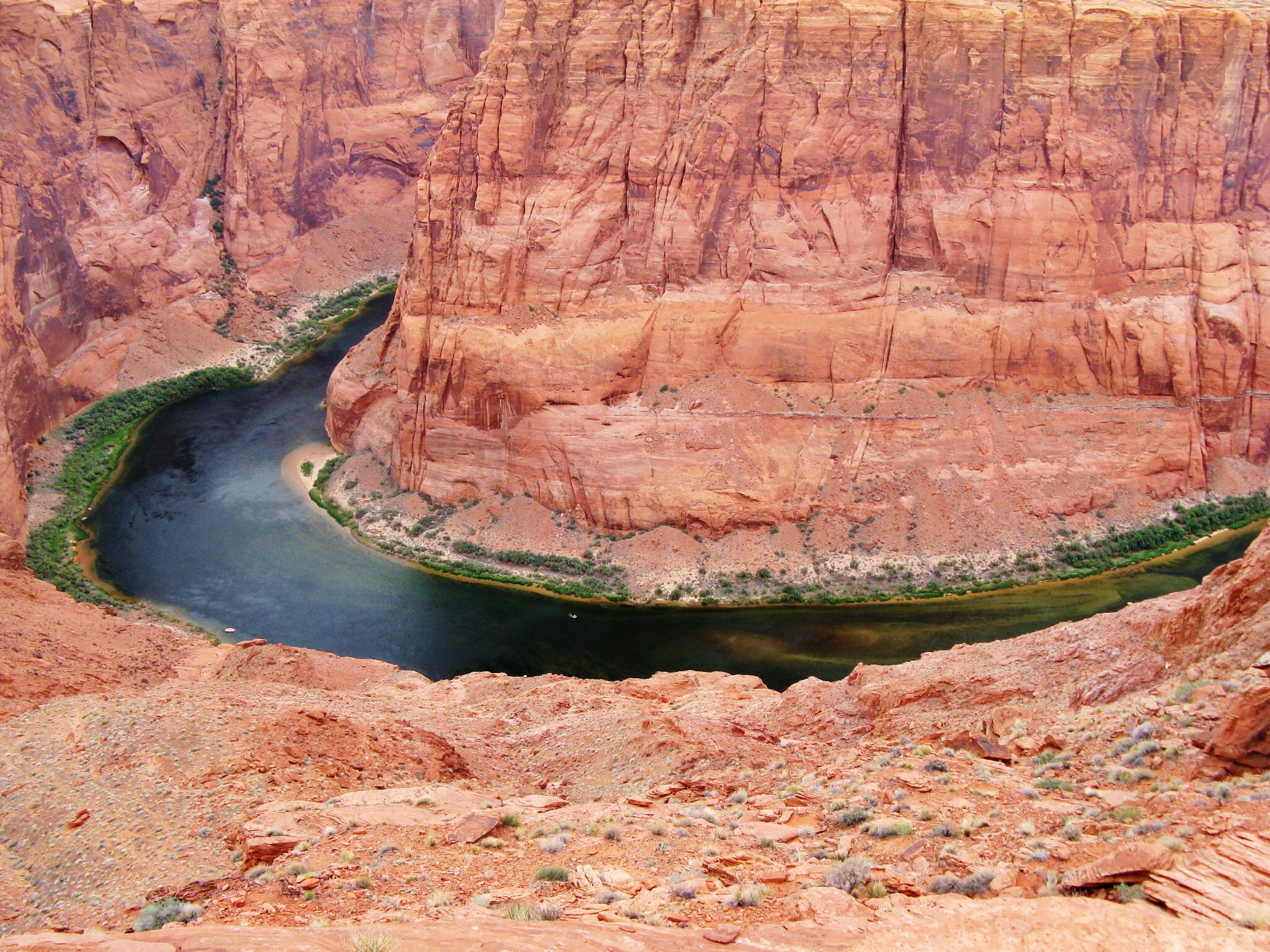
The next morning I dropped some 5700 feet in elevation, passing the impressive Vermillion Cliffs on the way, to Lees Ferry in Glen Canyon National Recreation Area. My new campsite had expansive views over the Colorado River, newly released from Glen Canyon Dam and flowing free on its 230 mile run to Lake (Reservoir) Mead. It was no longer the Big Red I saw in Moab; here it was sparkling clear, the upstream sediment left to settle in Lake Powell, destined to eventually render Glen Canyon Dam inoperable - “eventually” estimated to be 700 years by the Bureau of Reclamation, 50-70 years by more sanguine dam critics.
Just below the campground, the Pariah River oozed from the north into the freshly scrubbed Colorodo, delivering a thick sediment load more typical of rivers on the Colorado Plateau. The startling contrast of the mingling streams extends for a short distance before the minuscule Pariah is absorbed by one of the continent’s mightiest rivers.
 |
| Big Red? |
 |
| Colorado River |
 |
| Pariah River |
 |
| Pariah River Entering Colorado River |
 |
| Colorado River - note swimmer |
The nearby Spencer Trail climbs to a fine overview of Lees Ferry and beyond. It was a muggy, hazy day gone mostly overcast by the time of my late afternoon ascent, the air cooling but the light growing dull. Hopkins’ trail description pointed out the formations I was ascending, but it all looked like one big rock pile to me, rubble-forming formations I supposed. Even before the top, the views open up in the far downstream distance to the Colorado River cutting into the Marble Platform to create Marble Canyon. It’s a great scene that continues to perplex me, as I insist on wondering how all that rock eroded even as I read that it really didn’t. Marble Platform is the Kaibab Formation, the same rock formation that comprises the rim at Grand Canyon. The process was not erosion but uplift: the surface of the earth rose. I just have a hard time imagining uplift.
 |
| Colorado River Entering Marble Canyon |

The river launch was doing brisk business the two days I was there. Bundles of rafters were organizing for their floating trip down into Grand Canyon. One of the most coveted recreation experiences in the world, it was a prospect I had previously dismissed but now found myself looking on longingly. I would love to see some of those inner canyon grottoes and waterfalls. Unfortunately two weeks of all that cramped company would make me nuts.
I would like to have stayed to ponder the geography, but Lees Ferry was just a pit stop. I was heading into the next leg of my journey, a mini-leg, the Colorado portion of the Colorado Plateau: Mesa Verde, Black Canyon of the Gunnison, Giant Sand Dunes, Colorado National Monument. Navajo National Monument along the way as it is reputed to have a good campsite. I called first to check availability before showing up late Friday evening in the middle of nowhere, and the welcome was clear: come, we have lots of available sites.

No comments:
Post a Comment