Monday, December 19, 2016

Lassen Volcanic National Park


The last post featured a dog. This one may or may not offer a cat.

Oregon was largely a bust. I had hoped to do some hiking around Mount Hood but ran into a full-on, early autumn, northwest rain storm. I drove around the mountain to maybe get some sun breaks, look at a waterfall even, but it was hopeless. I figured I could at least poke around Timberline Lodge for a bit but even there the horizontal torrents turned me back in the parking lot. In compensation, I had lunch in Portland with former Third Place Booksellers Erin and Abraham, on the verge of having their baby daughter. Then I headed to Bend where the forecast was more promising. I wanted to hike South Sister – I had done it once before, in a smoky haze - but the rangers informed me that South Sister was expecting a snow storm. So I gave up and headed to California, where I finally achieved one of my goals: hiking to the top of Lassen Peak.

I - Lassen Peak – September 21, 2016 – Lassen Volcanic National Park

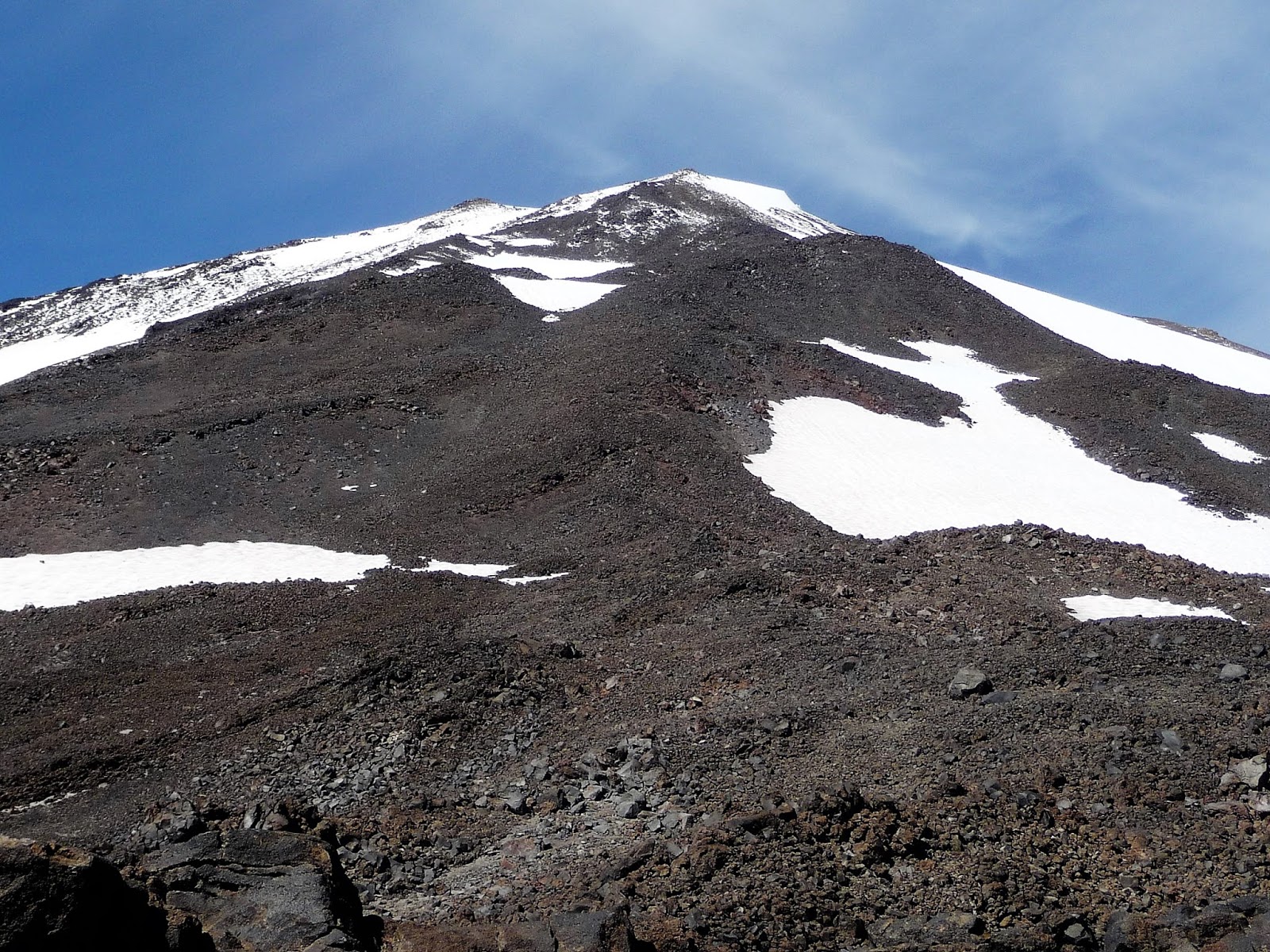
Lassen Peak is the southernmost volcano in the Cascade chain extending from Mount Garibaldi in British Columbia all the way to northern California. Lassen is unique in a few ways among these volcanoes. It is the only one of the major Cascade volcanoes that is not a stratovolcano. All of the others were built up by many eruptions over thousands of years, each eruption adding increasing bulk to the central cone. Lassen is a plug volcano, which means it is basically one mass of rock that emerged via flowing lava in a short period of time, apparently in just a few years. Lassen is also the only major Cascade volcano without glaciers; it has only a small and diminishing permanent snowfield. Lassen is no beauty once the winter snow melts; it has exactly the looks one would expect from a plug volcano, even without knowing what a plug volcano is. Above all, Lassen is the only volcano in the continental United States to have erupted prior to the 1980 eruption of Mount St Helens. Its eruptive period lasted from 1914-1917, with the biggest blast – in May, 1915 - devastating three square miles, a devastation that remains quite evident one hundred years later.

Lassen Peak


For my purposes though, Lassen is unique for its accessibility. It is one of only two Cascade volcanoes - Oregon's South Sister being the other – that day hikers can summit via an ice-free trail. Unlike South Sister, which is a bit of a beast, Lassen Peak is only 5.0 miles round trip with a 2000 foot elevation gain, modest numbers for strong hikers. The peak's 10,457 foot elevation does add the difficulty of thin air and tougher breathing for the unacclimated, which at this point certainly included me.

The hike's biggest challenge, though, is the cold wind. Lassen is the tallest peak in an abrupt mountain front and catches all the wind coming east across the Sacramento Valley. With this in mind, I waited out a couple of cloudy days to make my ascent on a day with a sunny forecast . Alas, the sun did not emerge from behind the thick overcast for most of the day, while the wind was strong and unrelenting - maybe not by mountaineering standards but certainly by those that day hikers are used to dealing with. The trail, which was in excellent condition, weaves its way up around boulders and krummholz that provided sporadic wind breaks, but without the sun this relief was meager. Hikers descending from the top, or from as far up the mountain as they had gotten, were mostly running, and not with glee. There was not a lot of pleasure being had out there that morning as far as I could tell.


Trail to Lassen Peak


 The visuals were not that inspiring either. In the gray light the volcanic rock was dim and dull. The sole bright spot lay on the southern horizon, where blue sky lit up a big beautiful lake. I was ready to write off the hike as something one might do in order to do it, but otherwise having little inherent value. Then the sun finally broke through and that helped a lot. It was still freezing in the wind but I was able to warm up in the windbreaks in preparation for the next bout of exposure. Plus the rocks started taking on some color. This proved valuable near the top of the mountain, where really for the first time all day I saw some exciting scenery, the remains of the two craters blown out in Lassen's 1915 and 1917 eruptions. I would very much have liked to explore them, but it was just too cold. Instead I headed straight for the summit.

Lassen Peak Crater


Lassen Peak Craters


Lassen Peak
from Lassen Peak trail (note wind on lake)


The official trail ends shy of the summit, so getting to the actual top requires a short but steep scramble over loose rock and unstable terrain. I had no real trouble with the footing but for the first time all day I felt the elevation on my lungs. And have I mentioned it was windy? Still, I was glad I made the extra effort. For one, the summit itself consists of a jumble of boulders that I could position myself within to maximize sun exposure and minimize wind. From this cradle I could look out over an entire 90 degrees or more of landscape that was not visible the entire way up, landscape that for me was the most spectacular of the day. In fact, the summit raised my opinion of the entire hike. I'm not sure I'd do it again, but I don't entirely dismiss the idea.

Lassen Summit


from Lassen Peak


Geology Interlude
Compared to 1980 Mount St. Helens, the 1914-17 eruptions at Lassen were small beer. They were not eruptions of pent up lava but rather a succession of steam explosions, caused by rain and snow melt seeping into the volcano, encountering molten rock, turning to steam, and exploding back out. In the first year of activity more than 180 of these explosions occurred, sending ash plumes as high as 10,000 feet above the mountain and tossing massive boulders down its side. The ash fell back to blanket the surrounding towns, but the boulders threatened only those curious enough to climb up to take a look. No real damage was incurred in the sparsely populated lower slopes.

This ended abruptly one night in May 1915 when a steam explosion blasted out a newly formed lava dome, setting off an avalanche that developed into a lahar and eventually a flood. A lahar is a mudflow that picks up boulders, trees, dump trucks, whatever along the way, a powerful, destructive force that destroyed everything in its path for seven miles, including several mostly unoccupied homes. The handful of people who were home that night were lucky indeed. According to the story, a dog wakened his owner to the danger and the man ran a mile to alert the other residents who then scrambled to safety. Sounds a bit too much like a Lassie adventure to me, but what do I know

The largest explosion came a week later. Rising lava had created another new dome and once more a steam explosion blew it out, sending a column of ash and gas more than 30,000 feet into the air, and setting off a pyroclastic flow: a high-speed avalanche of gas, hot ash, pumice, and rock fragments that devastated a 3-square-mile area. Once again a resulting lahar and flood swept through and somewhat extended the destruction from the week before, though this time no human lives or much else for that matter were in the way. Lesser steam explosions continued for another couple of years but gradually subsided, and Lassen Peak itself - though not the area of what is now the national park - has been quiet ever since.

Volcano experts refer to the 1914-17 events at Lassen as “relatively small”, but they caused a lot of excitement at the time. Of course they were big for the people nearby, demonstrating that secondary features of even minor volcanic events – mudflows and flooding - can be more dangerous than the eruptions themselves. Lassen's eruptions were also big for US vulcanism. This was the first time anything like that had happened in the US, allowing local geologists to explore and witness it first hand. A local amateur photographer by the name of Benjamin Loomis produced one of the first extensive photographic studies of a volcanic eruption. Plus no one at the time knew what was going to happen next, so the excitement is understandable.

President Roosevelt had designated portions of Lassen a national monument in 1907 but efforts to elevate it to a national park had run into solid opposition from ranchers and the US Forest Service. The 1915 eruptions swept aside these objections and Lassen was made a national park in 1916. Given the later assessment that the eruptions were a bit overrated, this promotion might seem hasty, but I don't think so. Lassen is a great volcanic study area, more so I believe than St Helens. Other than its largely inaccessible crater dome, St. Helens mostly offers a (terrific) landscape of destruction and recovery. Lassen has ongoing volcanic activity all over the place: steam vents and hot springs, fumaroles and mud pots, cinder cones, dacite domes, the works. Every known volcanic feature, says the NPS, except geysers.

II Brokeoff Peak – September 24, 1916 – Lassen Volcanic National Park

In fact, Lassen Peak is only a recent and comparatively minor incarnation in a landscape that has been volcanically active for 3 million years. Activity in what is now the national park began about 600,000 years ago, with the gradual construction of a large stratovolcano that geologists call Brokeoff Volcano. Brokeoff Volcano was about 11,000 feet high, roughly the height of Mount HoodIt was active for about 200,000 years before the eruptive center moved to the northeast and began sprouting a field of dacitic lava domes, many of which remain features in today's park. Lassen Peak itself did not emerge until roughly 27,000 years ago. A latecomer, yes, but also one of the largest plug volcanoes in the world.

In the meantime Brokeoff Volcano had been gradually eroding away, as the hot acidic water of its internal plumbing had turned hard lava into an easily eroded soft clay, which ice age glaciers made quick work of. Several of the current park's more prominent peaks - Brokeoff Mountain, Mount Diller, Mount Conard, and Diamond Peak – are remnants of Brokeoff Volcano, forming a rough semi-circle that marks the outer circumference of the eroded stratovolcano. And inside this semi-circle, what geologists call the “central depression”, lies a landscape that for me is the best part of the entire park. The eroded remains of the inner-volcano, hundreds of thousands of years on. Entire mountain walls made of soft white/pink/brown rock. It seems more spacious and in fact it is, like Yellowstone National Park though on a smaller scale, it is the center of a volcano that is no longer there.

Furthermore, this “central depression” is located in the south western section of the park where, descending from Lassen Peak toward Kohm-Yah-ma-nee Visitors Center, the ecosystem stages a dramatic transformation. The park is said to sit at the ecological crossroads of the Cascades and the Sierra Nevada, and the transition is startling. Up north, Manzanita Lake has a very northwest feel, dark forest and very rocky (though those rocks are largely the result of a collapse of another volcano, the Chaos Crags). The southern part of the park, is more, well, Californian: drier, sunnier, golden hills, fields of rabbit brush and mule's ears, the latter past flowering and looking like miniature corn stalks. The juxtaposition seems even odder to me since the southern section sits at a higher elevation. I've yet to find an explanation for this phenomenon, but I haven't given up either.

Brokeoff Mountain over "central depression"


Brokeoff Mountain


Rabbit Brush

Brokeoff Mountain


The park's main road slices right through this central depression so I could do my admiring from roadside turnouts. My favorite view is across Little Hot Springs Valley to a thick long ridgeside, nicely timbered but no so much to block out that lovely rock color or the rock formations not yet broken down. I take scores of pictures but it is hard to get the whole thing in its full glory. These are the best I've gotten so far.


For a closer look I set off one Saturday morning toward Brokeoff Mountain, looking very attractive as it loomed above southern portion of the park. At 9,235 feet, Brokeoff is the second tallest peak in the park behind Lassen itself, and entails a longer, steeper hike (7.2RT/2600' elevation) In compensation, I figured, it is surrounded by meadows and forest, not the harsh rocky slopes (or hopefully the abrasive wind) of the higher peak. A sign at the trailhead warned of cougar activity in the area but that is a fairly common thing. My feeling on cougars is somewhat fatalistic I guess. The signs always say to keep alert for cougars, a warning I find humorous. Cougars are top-grade stalkers and if you happen to see one it is mostly because it chose to show itself. If it decides to hunt you, you will likely become aware of it when it lands on your shoulders with its incises seeking the back of your neck. Happily, this is a very rare occurrence for humans.

I don't think I was more than a quarter-mile from the trailhead when I heard - very close by, on the other side of some thick foliage right in front of me – an aggressive growl of the sort I have never heard before other than on TV. I yelled and leaped backward with a sense that I could at any second be fighting off a cougar. No cougar, no sound, no anything came out of the brush and so I did what experts advise, back slowly away, keep your eyes open. Still nothing, so after a certain amount of backing away I turned around and returned to the car. No Brokeoff Mountain for me.

 Was it a cougar? I cannot say with certainty. I didn't see a cougar and am not familiar enough with them to positively identify their growl. I'll tell you this: if it was a lesser cat, a bobcat maybe, I sure would never want to hear a cougar up close. I am pretty sure it wasn't a bear. I'm more familiar with bears and it didn't sound like a bear. Plus a bear would not have remained quiet. It would have rumbled off into the woods making a lot of noise. Was it my imagination, stimulated by the trailhead warning sign? I doubt that very much. I've seen many such signs, and while I can be startled by my own shadow I have no history of imagining things in the wild. I heard that growl very close up and have to conclude it was a cougar. That's all I can say.

I reported my experience to the park ranger at the entrance station. She seemed to take me seriously and told me she would pass the information on. What might be done? Presumably nothing. Parks don't close trails for cougars like they do for grizzly bears. There already was a warning sign. My concern was that the cougar had possession of a kill, which was why it was defending its ground - I sure as hell didn't catch it unawares. But if this were the case the cougar would presumably have moved its kill to more secure terrain immediately after encountering me, first hiker , hiking alone, early in the morning.

III – Ridge Lakes – September 24, 2016 – Lassen Volcanic National Park

So somewhat anticlimactically, I set off on a substitute hike the ranger recommended, into an area more or less adjacent to one I abandoned, and yes I did imagine the cougar coming over this way, seeing me again, and deciding to get rid of me once and for all. This hike was a short but very steep ascent to Ridge Lakes, set in a beautiful basin with the the loveliest pinkish-white soil a clear indication of the eroded inner volcano. The ranger said I could extend the hike as long as I wished by climbing to the high ridge encompassing the lakes, a ridge that also connected Brokeoff Mountain to Mount Diller, thus constituting the outer edge of the eroded Brokeoff Volcano. There was no more trail but my hiking book offered two scramble options. I tried the one that headed toward the lowest saddle, figuring I could proceed further along the ridge from there, on the way passing through the largest lupine field I'd ever seen. The lupine was not in flower but it must be quite a sight when it is. From the saddle I could see Brokeoff Mountain, though not as clearly as I could see it from the road. I could also see a part of Lassen Peak, looking rather inauspicious.


Ridge Lakes
Ridge Lakes


lupine


Lassen Peak on right


The slope up from the saddle was too steep and slippery so I retreated to the lakes and went back up the other route. This was longer and harder but very rewarding. Here I actually climbed up through that nice mellow rock, though it lost a lot of luster up close, and of course it really isn't “soft.” It just looks soft from the distance. I also got to examine some of the remnant exposures of hard rock, the source of all that pink soil. Once on top I could see all the way to Mount Shasta, but I found the immediate terrain more interesting than the view. A fine hike, one I'd be happy to do again. Next time I would forsake the lupine field (unless it was flower season) and head straight up the second way, which appeared to offer an easier ascent to the ridge's high point. Such is the way that I develop hikes.  


After my hike I drove past the Brokeoff Mountain trailhead and saw the parking area was filled with cars. I have no idea if there were more cougar encounters that day. Probably not. Whatever I heard had presumably long fled the area.


For my first visit to Mount Lassen, see Lassen Volcanic National Park (Jul 2008)

Monday, December 5, 2016

Friends

Since I was spending the summer in the Cascades, Puget Sound people could meet up with me to go hiking. Two people managed to overcome the communication and logistics issues to do so: Anna Clark in mid-August and Anje Monte Calvo in mid-September, nicely bookending my abbreviated Cascades summer.


I – August 11, 2016 -  Hidden Lakes Peak – Mt. Baker Snoqualmie National Forest

Anna and her five-month old puppy Riley met me one morning at Marble Creek Campground along the Cascade River. Anna drove us up the steep narrow dirt road to the Hidden Lakes trailhead while I provided valuable advice and admonition from the passenger seat. The road got us to 3600 feet on Hidden Lakes Peak, more than half way to its 6900 foot summit. Not that we expected to summit. The primary destination is the 6600 foot saddle overlooking Hidden Lakes. I didn't know if we'd make that, but the hike is pretty great at any other number of intermediate destinations, so I felt confident we would have a good day.

Riley


Anna


The first mile of the trail is a modest climb through forest, crossing several small-to-middling creeks along the way. The first creek was quite small but still Riley balked. Apparently he had never crossed over running water before and did not seem inclined to begin. This time Anna simply picked him up and deposited him on the other side. The next crossing was a more formidable middling creek. Riley took one look and immediately turned and headed back toward the car. Leashed, he didn't get far, but his intentions were clear and persuasion was out of the question. So again Anna picked him up, but this time she dropped him in the middle of the creek. He reacted with good instincts, dashing to the other side, and I complemented Anna on her brilliant strategy. She admitted it wasn't really strategy, she had just dropped him. OK, inadvertent brilliance.

Out of the forest, we entered the meadows of Sibley Creek, the heart of the climb. These meadows are outstanding, as lush and green as any Cascade meadows I know. They are also very steep - what are known as vertical meadows – as well as one of the more consistently fly-ridden. My usual strategy is to hit this trail early, while the flies are still in their pre-swarm strategy meeting. But Anna had driven all the way from Lynwood so the flies were ready for us. They were particularly attracted to Riley, at times nearly engulfing him. His main defense was to eat them.


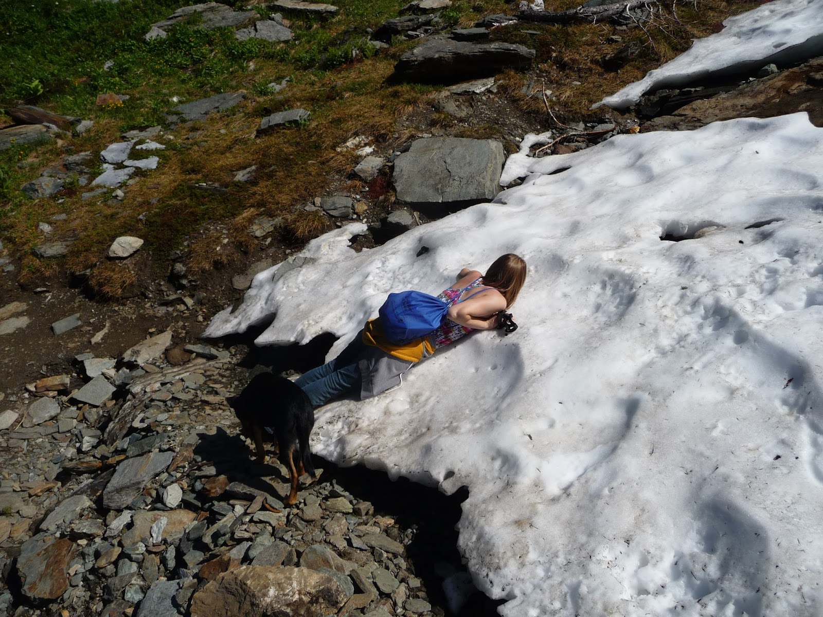
The slopes are also relatively shade-less, and it was a hot day. The combination of steepness, heat, and flies posed a challenge. When we tried to rest in what little shade there was the flies made it unbearable, forcing us to resume climbing quicker than we'd have liked. The lack of optimal rest took its toll, and Anna began to flag. It was way too soon to quit so I spotted a small snowfield up at the top of the meadows and declared that to be our goal. Actually my goal was much further, but if we didn't get to the first goal we sure weren't going to get to mine. I'm not sure Anna even saw the snowfield I was pointing to, as when we got there she seemed surprised and delighted, immediately collapsing onto its cooling mass. Riley was more circumspect; he'd never seen snow before. He approached it cautiously, leading of course with his nose, and upon contact shot backwards 15 feet like I'd only seen before in cartoons. It was hilarious. But he got the point quickly enough and was also finding relief and refreshment on the icy oasis.


As it happened (well, I had known it already), the snow was where the steep ascent gives way to a long but much more temperate crossing of a high ridge across the front of the mountain. The flies also started to thin out at this point. As I had hoped, the respite provided us with new life and we strolled the ridge with greater pleasure. The views had been pretty great for a while but became increasingly spectacular, with wave after wave of mountain emerging in view the higher we went. First they were green with meadow and timber, then rocky and jagged, finally glaciated, the latter extending as far as the eye could see. Mount Baker, appearing early in the mid-distance, and El Dorado Peak, emerging somewhat later, were the highlights, but the sheer number of peaks, too many to name, was the best part, in my opinion.


The trail crossed mostly heather meadows punctuated by scattered stands of sub-alpine pines and enormous blocks of granite. Small creeks and springs continued to pour from the snow above us, and Riley learned to drink from the clear standing pools. He would not drink from moving water. Anna informed me that this was her first time she had seen alpine flowers. Raised on Bainbridge Island, she was a life-long sea level girl.

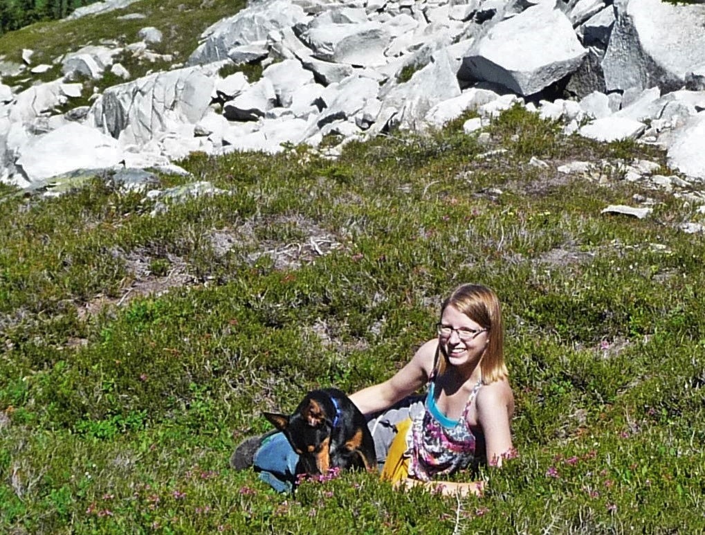
This stretch of trail entailed more climbing than I'd remembered and it gradually became clear we weren't going to get all the way to the overlook of Hidden Lake. I held out for one last snowfield, and there, with a view of the fire lookout on Hidden Lakes Peak's lower summit, we declared victory. One companion reclined in the flowers, the other pranced about in the sunny snow. I was happy enough with our achievement. I realized that though we did not get to the hike's “official” destination, we had attained a terrific destination unto itself, for Anna and Riley's first mountain hike.


The highlight on the descent came when we got to the creek that Anna had dropped Riley into on the way up. Seemingly recognizing it, Riley burst out ahead and led the crossing, picking, I noticed, the very best place to cross. We got back to the campground and had dinner at the picnic tables among some big leaf maples. I served Progresso Chicken Noodle Soup; I always serve Progresso soup. I should get promotional fees from Progresso Soup. Now Anna has access to homemade soup every day at work, so after eating her chicken, noodles and carrots, she passed the salty broth onto the more appreciative puppy. We visited the river and Riley did more prancing. Then off into the night they drove, Anna anxious to get some snacks for the drive, leaving me to worry their safe return.


II – September 12, 2016 - Panhandle Gap – Mount Rainier National Park

I was at Trout Lake recovering from my Mount Adams adventure when Anje and I finally made our plans. I spent most of a day driving the forest service roads back to Silver Springs Campground outside the northeast boundary of Mount Rainier National Park, where she could meet me and enter the park on my very important person senior access card. That evening, more friends – the Hobbes family – Judy, Rod, and Brian – stopped for a quick visit at my campsite on their way back from hiking on Burroughs Mountain. Judy had brought a gift - some dehydrated peanut butter I had been asking about, and I can say it is decidedly better than starving to death. They declined my offer of Progresso Soup.

Anje arrived early the next morning and we headed to the Summerland trailhead. A Monday morning in mid-September and the small parking lot was already filled: this is a very popular trail. I myself have probably hiked it more times than any other trail. It begins with several miles of steady but modest ascent of forest, switchbacks providing rest stops over rocky gorges of Fryingpan Creek. We crossed the creek on an ancient footbridge and climbed some switchbacks through flower gardens largely gone to seed by this time in the season. The Summerland meadow presented a classic view of Mount Rainier and Little Tahoma over golden autumnal meadow grass before the trail climbs a flight of steps alongside a lovely creek lined with monkey flower and lewisia.

Mount Rainier from Summerland

Summerland is small and we were in and out of it pretty quickly, entering the part of the hike that makes it nearly an annual hike for me. Beneath the daunting Meany Crest, a narrow bridge crosses a roaring creek just barely emerging from snow melt, leading into a rocky area that is free from snow maybe six weeks a year. Spring, summer, and fall come and go in a hurry, and tiny little flowers were still blooming. I introduced Anje to my favorite tarn in the whole world, and we dilly-dallied around it. Anje was much impressed by the color of the rocks, mostly green and pink. A couple of prize winning patches of moss added almost incongruent life. And that's just the ground. Looking up, the views rather stagger the brain. One of my favorites anywhere focuses on the spot where Emmons Glacier descends through lateral moraines to intersect the greenery of Goat Mountain, Burroughs Mountain providing backdrop. A bit later comes a view back to Little Tahoma and Rainier looming above the periglacier ground, my tarn very much included. This is also one of my favorites in the whole world. That's two in one hike.


Anje


Emmons Glacier, Goat Mountain, Burroughs Mountain


Earlier in the season the hiker winding up to Panhandle Gap can encounter a steep, dicey snow field, but here in mid-September we crossed a mere patch. At 6800 feet, Panhandle Gap is the highest point on the Wonderland Trail. It also happens to be the hydrologic divide between Puget Sound and the Columbia River, and the view opens to Mount Adams, the Goat Rocks, and on clear days, including this one, Oregon's Mount Hood. We had a nice lunch amid 360 degrees of splendor. For many this is the final destination, but there's so much more to see. The resident herd of goats, for example. I had asked some returning hikers if they had spotted any goats and they had not. Now this is as reliable a herd of goats as the one at Ptarmigan Ridge and I concluded they had not tried too hard. So after unch I said to Anje “Let's go find some goats”, and led the the way along a narrow use trail heading east from the pass. We hadn't gone twenty yards when Anje announced “there they are”. A huge herd, more goats than I had ever seen here, were plastered quite conspicuously to the steep grassy slopes rising to the east.


Panhandle Gap


Mountain Goats

Apart from the goat herd, this sloping green meadow offers a tantalizing view from the top, where it ends abruptly at the shocking cliffs and spiraling towers of the Cowlitz Chimneys and the still-imposing remains of Savant Glaciers. From Sunrise these rugged glaciated volcanic plugs comprise the snowy extension of Mount Rainier and Little Tahoma, appearing accessible to only the hardiest of climbers. Yet from Panhandle Gap they are a hands-in-pockets stroll, one very few people take. Usually I add this stretch to my hike (or continue on down the Wonderland Trail to views of the Ohanapecosh Glacier) but it had only been three days since my Mount Adams ordeal so I was reluctant to overdo it. I told Anje I'd be happy to wait behind if she chose to go, and to my surprise she took me up on it. (She later acknowledged it was further than it looked.) I was happy as pie reclining in this meadow: beautiful day, light breeze, warm sun, no bugs, not another person around, while Anje respectfully worked her way up and around the goats. I don't know exactly what Anje saw up there as she had used up her camera battery (Panhandle Gap will do that to you). But this is what I saw last time I was there.


I was just starting to get restless when I spotted Anje came back with a piece of goat's beard to show me (of course she left it there on the meadow). We descended to Panhandle Gap and I was surprised to find we were the only ones left, surprised until Anje told me it was 4:30. Rather late to be at Panhandle Gap in the middle of September, we would need to hustle back to beat dusk. (We both carried headlamps, but still.) So we hustled, sort of. We had to examine a little reflective puddle at the base of a snowfield, say goodbye to what I feel was the summer's best patch of moss, and stop to count a small breakaway herd of goats making its way across the base of Meany Crest. I'd never seen goats there and I wouldn't think it would be such a receptive habitat, but I have to trust the goats know what they're doing.


We made good time dropping down through the woods, a little better time than my knees would have preferred. Each drop down hurt, a pain I registered with a manly yelp. But the fact is I was encouraged. This wasn't the pain of injury, this was pain of sixty-two year-old knees hiking downhill too quickly at the end of a long day. Anje said her knees were hurting too though she suffered more silently than I was managing. Finally, not in response to anything she said, or for I know was even thinking, I said what needed to be said, which was “Listen Flynn, either shut up about your knee or quit hiking!” (I wonder if maybe I was channeling Wesley). And I did, shut up about my knee that is, and we talked about BBC Mystery the rest of the way down. Though the park service seemed to have tacked an extra couple of miles to the trail we eventually got back to the campground, where I served Anje some Progresso Minestrone soup before she took off on her dark drive back to Seattle.


Thus ends the “Take Care of Your Knees, That Might Work for You” segment of my story. You won't hear another thing about my knees, at least through the date of this posting – December, cheez! (They're doing just fine.) This leaves me without an organizing theme for my subsequent stories. Have I mentioned my painful rotary cuff


Wednesday, November 16, 2016

Mount Adams

September 9, 2016 - Mount Adams Wilderness -  Gifford Pinchot National Forest

Back in Seattle for a couple of days, with friends in kitchens and living rooms, we discussed many things, including, as it happened, my knee. (I'm almost positive I didn't bring it up.) One friend nodded knowingly to my chagrin that my knee would be fine until one bad step produced excruciating pain. She had endured that syndrome for months before finally getting the MRI that confirmed she had a torn meniscus that would require surgery, followed by several months rehabilitation. She noted grimly but wisely that a torn meniscus does not get better by itself. The thought of having to schedule an operation and then spend months recovering was horrid, so I grasped at grounds for hope. My most recent injury was to the back of my knee and everyone agreed that would not be the meniscus. Maybe it was just an anomaly, albeit one likely caused by a weakened knee. That would leave the main problem what I had self-diagnosed as osteoarthritis, which is not something to be operated away and was something I believed I was making progress on.

So before scheduling an MRI I would give my theory a real test. I decided – declared, in fact, to witnesses – that I would not backpack for the foreseeable future as that extra weight obviously added pressure on the legs. Secondly, I would restrict my hiking to established trails, foregoing (eschewing, if you will) off-trail gallivanting where footing is almost by definition going to be more precarious. By keeping to these two vows I would see if my knee could get stronger without further injury.

Three days later – Three days later! - I found myself not only off-trail but trying to descend a steep rocky slope at the base of Mount Adams, with every step I took starting some form of rock slide. It was as precarious a position as I'd been in years.

I had long wanted to hike up the southern slopes of Mount Adams. Photos of the peak from Trout Lake looked great, and icy peaks always look better from the south (in the northern hemisphere, that is), with the sun shining from behind the viewer. I'd read about a destination called the Lunch Counter, a base camp for climbers seeking to summit Adams, and it sounded like a good goal. So down to the Trout Lake ranger station, where I learned I would need to pay $15 for the hike, neither the Northwest Trail Pass nor the Senior Access accepted. Then came a long tough dirt road up to the trailhead, through the remains of a massive fire from a few years earlier. At one point I came upon a hole in the road I knew my Yaris could not handle and I backed up a couple of hundred feet down the narrow road, etched along a steep cliff, one side steeply up, the other abruptly down. A Suburu at the bottom was waiting for me to clear the road, and without a nod the driver proceeded up the road. I watched as he managed to squeeze between the hole and the cliff wall, and decided my car was no wider than his. So I followed his example and finally arrived at the trail head, more than a little flustered.

The trail started climbing through a continuation of the burn, always a bit pictorial. The fire had burned pretty much to timberline, and above it only a few scattered stands of whitebark pine stands provided relief from the expansive fields of gray volcanic rocks. In short, there was little shade the entire way up, and even though the temperature was rather pleasant, I was pretty hot. I imagine this hike would be brutal on a hot summer day. I also noticed that with each step my view of Mount Adams was decreasing. I hoped this would be a temporary development, but this hope would prove unfounded. The best views, it turned out, were on the road up.


Overview of Trail


Last View of Mount Adams

The trail climbed steeply up and around what my trail guide called a glacier, but I was unable to recognize any of the small patches of white as being an actual glacier. I suspect it is gone. The gray rocks then gave way to piles of purple volcanic boulders, almost razor sharp, not a good place to lose one's balance. A couple hikers were tentatively descending these boulders and asked me if this was the trail down. It appeared obvious to me and I assured them it was, but I didn't register that maybe it wasn't so clear on the way down. I had missed an important clue.

Finally I got to the large snowfield leading up to the Lunch Counter. I had known I would be crossing it but in the trauma of my drive to the trailhead I forgot to put on my UV glasses. I had to pull my hat as low as possible and squint a lot. It was a long way up, the most interesting snow feature of the day getting a bit larger with every step. At the top of the snowfield I spotted a large area of snow-free camps a bit to the west. No one was camped there but the boulders threw small patches of shade and I gratefully cowered in one as I nibbled at some lunch. The southern view of Mount Adams was not what I had hoped for, to put it mildly.

 
Up the Snowfield
View from the Lunch Counter (I think)

Over on the far side of the snowfield I saw groups of climbers hanging around. I thought maybe that was the Lunch Counter, and that it had better views of Adams than the one I had, but to get there I would have had to ascend more snowfield and I had had enough of that for one day. I was exhausted and knew I had a long way back. Ironically, if I had crossed over to that side I would have descended the proper snowfield, and quite likely avoiding the subsequent debacle.

Sliding down the snowfield was rather fun. I even essayed a posterior glissade, something I'd never tried before. I only did it once because I slid down so fast I could barely stop myself. Maybe I got a bit too engaged in the speed of my descent, as I missed another clue. I had spotted a young woman hiking down the other side of the snowfield but didn't really register that she had disappeared behind a rocky divide. I was complacent because I was following fresh footprints; others had gone down this way, recently. It had to be right. But when I got to the base of the snow I did not see the trail leading down. I didn't recognize where I had ended up, and only then realized I had gone down the wrong lobe of the snowfield.

I knew where I was in relation to where I wanted to be, so it was merely a question of how to get there. One choice was to double back up the snowfield and locate the proper lobe. That sounded awful. The other choice was to keep descending and gradually work my way to the east as I went along, which is what I did and how I ended up in my precarious position.

I happen to have a lot of experience descending steep rocky slopes and feel I'm rather accomplished at it. I tend to take it slowly and carefully and compared to a real climber I guess I'm not accomplished at all. Still, I always get to the bottom. This one was just tougher than I'd anticipated. As is usually the case, all the pebbles and small stones slid downslope almost on contact. The trick is to anticipate this and make sure you're not descending with them. The key is the big rocks: you have to use those as anchors, and usually it works. But this time the big rocks were some sort of slippery slate-like rock that wanted to slide as much as the pebbles. I had no anchors and I was in danger of launching a small rockslide that could take me down with it.

Progress was slow indeed as I worked my own switchbacks, down a bit with each lateral move. I had to calculate carefully, figuring out what was going to slide with each step. (There was no one else anywhere on the slope; I was not endangering anyone but myself.) A few big boulders held so I was able to rest a bit. By now I was dead tired but I was wary of resting too much because I was operating largely on the adrenaline of fear. If I rested too much I might lose that, my only real source of energy.

This all might sound terribly melodramatic, and I wondered even at the time whether I was making it harder than it really was. Sometimes the best thing to do is just plow more or less straight down, almost surfing the small rocks downslope, and I've done that before too. The problem was that if I were to do that my right knee would have had to lead the charge, digging in sideways with each step, and that was something I was simply afraid to do. I might have gotten down quicker but I also might have had to sit the rest of the year out with a knee operation. So down I picked, down I picked, and down I picked. A couple of those whitebark pine stands came in handy. They're not going anywhere, at least from my weight, though their branches are sharp enough to do some damage as well.

Eventually I was more or less at the bottom, in this god-forsaken graveyard of fallen rock. Now all I had to do was cross country to where I was supposed to be which I did but which also entailed more rocky descents. I regained the trail, my triumph deeply undercut by nervous exhaustion. Sunset on the burned out forest provided the only aesthetic relief.

The Route of my Rock Descent
Rocky Graveyard
Burn at Sunset
By the time I got back to the trailhead it was dusk. I was not about to drive down that road in the dark in my condition, so I would have to spend the night at the trailhead. Fortunately the trailhead had some very modest overnight camping sites and I was able to pitch my tent near a picnic table. It was a noisy night as many climbers were camping in the vicinity, so as to make an early start on the summit the next morning. A guy was sitting at the only table reading by red headlamp and I had to excuse myself and haul in my dinner paraphernalia. I had never seen a red headlamp and he told me it was what they used in the military. He was an Iraq veteran, on a break now from a post-military job in Afghanistan. He was a pretty interesting guy and we had a fairly pleasant conversation. I regretted being as absolutely exhausted as I was, as I was not able to engage him as much as I'd have liked to. A real writer would have had an interesting story here.


Trailhead Campground


Tuesday, November 1, 2016

Mount Rainier: Take Care of Your Knees...(continued)

September 3-5 : Peak Loop/Dege Peak/Berkeley Park - Mount Rainier National Park

Summer holiday weekends are a challenge when living on the road. Campgrounds get crowded and fill early, often with more partiers than I can tolerate (OK, any). I have learned, maybe somewhat counterintuitively, that this can be a good time to head to a national park. Big holiday campers don't tend to go to national parks. Parks charge an entrance fee, have strict restrictions on dogs, and offer campsites that are usually smaller and more tightly packed together than in most national forest campgrounds. You can't really spread out yourself out along the river. Campers at national parks tend to be serious hikers or people from out of state or other countries who have come specifically to see the park. They're not there to sit around the campground and party.

So this past Labor Day weekend I headed down to White River Campground at Mount Rainier, my local national park. I got there early in the week, Wednesday, a precaution that proved thoroughly unnecessary as the weather was fairly lousy. Not terrible, just heavily overcast with intermittent rain showers. Only one day was bad enough to keep me confined to my tent. But the splendor that makes it a national park was deeply camouflaged. Consequently the campground never filled up and on a couple of those rainy mornings it seemed oddly deserted.

View from White River tent

All of which was fine with me as I wasn't really ready to hike yet. My knee seemed to be improving rapidly though, so on Saturday when the forecast called for a little sun I was ready to try a short hike. Another great thing about national parks is they tend to have lots of good short hikes and Mount Rainier has plenty. I chose the Naches Peak Loop, leading straight off the highway at Chinook Pass, right at the border of the national park and the national forest. It is a fairly easy three mile loop, perfect for kids and there were a lot of them. I like kids when they're enthused and these kids seemed to be having a good time, especially picking berries.

The sun never did break through the thick clouds so Rainier itself remained thoroughly hidden. This made it a good day to experience the aesthetics of forest and meadow, often lost in the Mountain's splendor. I decided it would be a good place to take someone looking to experience a great subalpine ecology without paying the national park entrance fee, recently jacked up to $25. In fact, since the trail straddles Mount Rainier and the forest service's William O. Douglas Wilderness, people can bring dogs halfway around the loop, then head down along the PCT to Dewey Lake.


This hike went so well I went out again the next day on a four-mile round trip to Dege Peak out of Sunrise. On clear days the views from Dege Peak are spectacular, but once again only bits of sun broke through the vast fog banks, so it was another day to appreciate the smaller things. In fact this day's highlight was a small girl, four years old she would later inform me, churning up the rather steep trail to Sourdough Ridge, smelling the flowers and greeting the passers-by, myself included. I told her she was doing a great job and she said thank you. I figured her parents were good for getting her as far as she was, and was dumbstruck an hour or so later to see her breeze onto the summit at Dege Peak. When she spotted me she exclaimed “I did it!”, as indeed she had.

Emmons Glacier


Sunrise Meadow 

Feeling no pain from these modest efforts I went out again the next day, Labor Day. Not only was it the only sunny day of the weekend, it was the only decent day in the immediate forecast, so I decided to try the somewhat more challenging hike out to Berkeley Park. I figured if it clobbered me I'd have plenty of rainy days to recover. So once more I was with the crowds ascending the Sourdough Trail, watching as people peeled off at each trail intersection – to Dege Peak, Fremont Lookout, Burroughs Mountain, Skyscraper Pass – all trails with great views. If I were an infrequent visitor I'd be doing one of those as well, but by the time I was descending the trail to Berkeley Park I was the only one left. I would have the park gloriously to myself for an hour before a few backpackers came passing through. After that I would see two other day hikers the entire day, this once again on a lovely trail on a sunny summer holiday.

As meadows go Berkeley Park beats the pants off the far more popular Summerland. For one, it really is a park in that the meadow is rich with trees. It does lack a view of the mountain but for that you can continue on to Grand Park - a fine idea - for a big wide view. Mostly Berkeley Park has Lodi Creek, which has to be the best creek in the national park. It comes cascading down in full view from Burroughs Mountain and closely parallels the trail throughout. In a couple of places the trail comes down to meet the creek, where boulders fallen from the jagged cliffs high above are conveniently situated for lunch or nap.


Berkeley Park

Lodi Creek

Lodi Creek


Berkeley Park draws a bigger crowd in flower season, though like most Cascade meadows it can be very buggy in flower season. (Grand Park can be brutal.) That's all gone by September though. Yet the meadow was far from dry. Not only was the creek robust, so were the many springs and seeps emerging from the still-lush grass. It is truly a place to savor. After a mile or so the meadow gives way rather abruptly to a wonderfully spooky patch of old-growth silver fir, decked out in goat's beard. I've always noticed that this tree is typically thus festooned but I never focused on it until this rainy week. I began to research why but have found no answers. The trail descends to one last intersection with the creek before it begins to climb up to Grand Park, a bit too ambitious for me on that day. I was weary and sore as I climbed back out to Sourdough Ridge, but I was not in pain. This is progress.