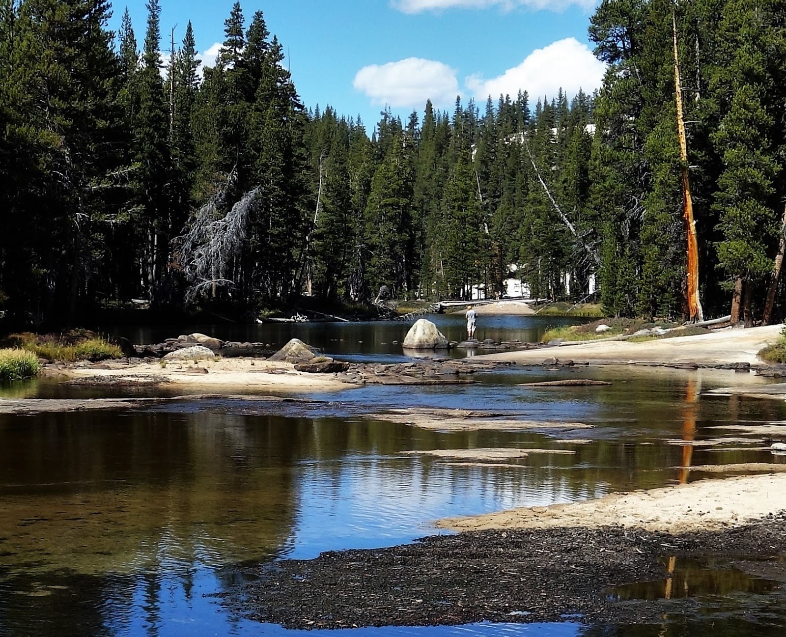
I - Horton Creek Campground - October 2016 - Bureau of Land Management - Inyo County, California
Mammoth Lakes is the only place I've seen with a Forest Service campground two blocks from a public library, and a pretty good one for these parts. That alone might have been enough to keep me there for a week except the nighttime lows were hitting the mid-20s and the campground host said they would stay that way, at least until it got colder. More even than quiet library time I needed some warmer evenings, and I knew I could get them, and less than an hour away, in Bishop. This is because Mammoth Lakes sits at 7880 feet at the head of a weather funnel sweeping up through the heart of the Sierras, while Bishop sits at 4150 feet in Owens Valley in the rain shadow of the Sierras.
So down another precipitous highway I plunged, this one significant enough to have its own name: Sherwin Grade. It drops some 3000 feet at a 6% grade for well over ten miles along Highway 395, an intermittent interstate with a heavy truck traffic that is restricted to 35 MPH down the grade. The rest of us could go 65 but I believe I was the only one who managed that. It wasn't easy to go that slow, but the views out over Owens Valley and the Sierra Nevada were thrilling. I'd have gone 35 myself if I thought I wouldn't be a road hazard.
My destination was Horton Creek, a Bureau of Land Management (BLM) campground where I had stayed a few times in the summer of 2008. It was such a bare bones affair I wondered if it was even still there, and when I couldn't locate it from memory I checked in at the Bishop Ranger Station and learned that it was, the same as always. Not only was it still there, it still cost $5.00, and it offered the Senior Discount. I'd be paying $2.50 a night and using every night of the 14-night camping limit. If I couldn't meet my budget here my budget could not be met.
I spent a lot of time there and it proved to be an intriguing place, so I'm going to describe it in a lot more depth than I ever have a campground. (Readers who don't find it as intriguing as I do might still consider part II, which is excitement itself.)
As I said, it's a simple place, the campground anyway. A nominally paved but reverting to dirt and rock road extends a mile or more up the middle of a gradual sagebrush slope. 49 campsites jut off mostly at right angles from both sides of the road, each site fitted with a picnic table, a metal fire pit, and some seven-foot-tall metal hook that I figured must be there for us to bleed the odd rabbit we happened to snag browsing in the sage. Any given site may or may not have a decent place to pitch a tent. Many of the sites have a few low plants and some featured a sickly-looking tree, devoid of leaves in early October. BLM had installed an underground irrigation system that was giving these trees water, so maybe they leaf up in the spring. The camp sites are delineated by large rocks and beyond the rocks comes a sea of sage brush and a lot more rocks. This is the very western edge of the Great Basin desert.
That's pretty much it for the campground; it's the setting that is worth talking about. First and foremost is the fact that Horton Creek is a small drainage running along the very base of the Sierra batholith. Straight out of the sagebrush, maybe a quarter-mile away from the campground, Wheeler Ridge rises to a height of over 13,000 feet. BLM says the campground sits at around 5000 feet, making Wheeler Ridge an 8,500 foot wall running along the west side of the campground. It didn't look that high, in part because of its breadth; the ridge runs north for eight miles. I could walk out of my tent across the sagebrush, straight onto the alluvial fans flowing down the mountain's steep canyons, and just start climbing the ridge. Of course an 8000-foot climb without a trail that entailed granite walls themselves 1000-feet high would have been a tad out of my league. Fact is I never saw any climbers take this behemoth on.
 |
| Wheeler Ridge from my Horton Creek campsite |
Flanking Wheeler Ridge to the south is 13,652 foot Mount Tom, the dominant peak of the Bishop skyline. A conspicuous trail does switchback up Mount Tom, a mining trail that does not make it to the top though would provide a pretty good view wherever it terminated. Utterly shadeless, it did not tempt me to see for myself. A line of peaks, most prominently Mount Humphreys, rise southward along the Sierra front as far as the eye can see. These can be better viewed by driving up the Bishop Creek Road, a story for another day.
 |
| Mount Tom from my Horton Creek campsite |
 |
| Sierra Range running south from Mount Tom (August 2008) |
 |
| Horton Creek Riparian Zone |
 |
| Horton Creek riparian zone and my dinner table |
Another mountain range, the White Mountains, runs down the east side of the Owens Valley. While not as consistently high as the Sierra Nevada, this range's high ridge runs 10-12,000 feet in elevation with several peaks rising to 13,000 feet and higher. White Mountain itself, the highest peak in the range, is 14,252 feet, the third highest point in California. These two towering ranges, varying from six to twenty miles apart, make the 3,000 to 4,000 foot elevation Owens Valley one of the deepest valleys in the world.
My campsite was much closer to the Sierras, in one of the wider portions of the Owens Valley, but the White Mountains still cast an imposing presence. Whereas nearby Wheeler Ridge glowed in the the early morning light, the White Mountains came to life in the late afternoon sun. It took a few days but eventually I identified White Mountain rising in the distance, a white triangle quite imposing once I realized what it was. On a couple of special evenings it held the last of the day's sun, and for a few moments glowed alone above the shadows of its dominion. (Alas it was too far away for a meaningful picture.)
 |
| White Mountains |
From afar the White Mountains appear to not be vegetated at all, but a sparse sagebrush community does cover the lower several thousand feet. Higher up on the peaks, altitude brings more precipitation and cooler temperatures, creating what is known as a sky island, and trees flourish there. In my theoretical campsite view, though well beyond my eyesight, grows a forest of one of the most venerable trees of all, the Bristlecone Pine.
 |
| White Mountains |
Rising further north above Round Valley is the 3000 foot ascent to Sherwin Summit, reduced to a mere slope by the adjacent mountains, but with a lot of action. The highway itself is not that big a deal in daytime but at nighttime it is the most prominent feature of the landscape, a line of headlights plunging down Sherwin Grade, looking with the foreshortening like an enormous escalator. It was always the first thing I'd see when I emerged from my tent after dark. It was 10-20 miles away, there was just nothing between it and me but open air. I could follow the car headlights after they hit the bottom of the grade, the view interrupted by some roadside cottonwoods. The cars appeared to be going very slowly but of course were going upwards of 65 MPH. They were just five or six miles away.
 |
| Round Valley with Highway 395 the slash just visible on far left |
All three conveyances - highway, aqueduct, and gorge – come down the Sherwin slope on (or through) a broad expanse of seemingly bare brown earth. Again, it isn't bare just sparsely vegetated, but it is a single rock exposure of some significance. Geologists call it Bishop Tuff, and it entered our world as rock a mere 760,000 years ago with a volcanic explosion “far larger than any historical eruption”, including the 19th-century Indonesian eruptions at Krakatoa and Tambora. The blast threw out 150 cubic miles of earth, greater than the volume of Mount Shasta, the most voluminous of the Cascade volcanoes. Some of this scorching pumice and ash flowed west into the Sierras and some of it blew east over the landscape, but most of it either flowed down or eventually descended back onto the land now extending north and south from Sherwin Summit. While most of this remains buried by subsequent deposition, erosion down Sherwin Grade has uncovered this large expanse, a volcanic tableland to the geologists, of Bishop Tuff. The place started to make me feel like To Think That I Saw It on Mulberry Street.
 |
| In succession: Horton Creek Campground; Round Valley ranches; Bishop Tuff volcanic table; Sherwin Summit |
 |
| Community extending across volcanic tableland. Not to mention the White Mountains |
Last but not least (sure, the anomalous neighborhoods are probably least), adjacent to the ranches in Round Valley sits a California Forest Fire station, operated says the sign in conjunction with the State Department of Corrections. Its lovely and shady little headquarters are just two miles from the campground, and while I couldn't see it from my site, I drove by it every day on my way in and out. A half mile from the campground a small group of houses sit on a road marked “State Housing: Keep Out!” - not “Do Not Enter” or “No Trespassing” but “Keep Out!”. I had to assume this is housing for the Department of Corrections component of the operation. These houses I could see from my chair, straight down Horton Creek on the other side of the narrow valley, directly, as it happened, in my sightline of the high peak of White Mountain. I could see no security fences separating us, leaving me banking on this being a very minimum security sort of place, though sometimes I feared this was why the campground only cost $5.00.
An oddity about this campground in the middle of the sagebrush is its excellent phone reception, better than I got in Bishop, better than I got in my basement apartment in Seattle. I had to conclude that this was courtesy of the Forestry/Corrections facility and I joked with the people I did call that our conversation was probably being monitored. Coming of age as I did in the late 1960s, I have always assumed my phone conversations were being monitored, and I always felt sympathy for these poor imagined monitors, just drowning in coffee to stay awake and listen to me babble.
I want to emphasize that except where noted, this entire scene was visible from my campground chair with just a swivel of the head. It started to seem like another planet, a cliche I know and not even an applicable one, as it was my planet, my country even. But it was also a landscape unlike anything I would imagine might exist in my country. The reason it does exist is easy to identify: the control Los Angeles Water Department has over the land and water of Owens Valley. Without this, I eventually realized, Horton Creek would probably be an upscale community. There'd be no ranches, no Department of Corrections and Forestry, no BLM campground, and no place I would be allowed to sit for two weeks pondering the place.
II - Horton Creek Campground - October 14-16, 2016 - Bureau of Land Management - Inyo County California
Just when I thought I had all this figured out, two punishing days at Horton Creek Campground gave me second thoughts about its potential for upscale development. One Thursday night, thick storm clouds gathered along the Sierra crest, obviously bringing precipitation (and a fiery sunset). The rain shadow was nicely enforced and the valley below remained clear, though an evening breeze did pick up. Things got a bit more serious early the next morning when I was wakened by a gust of wind that nearly brought my tent down on top of me. The crest was covered with a lovely coating of new snow and the morning sun did lovely things with the remaining clouds. Then it threw in a rainbow.

Rather than try to tighten my tent up I just broke it down and went to spend the day at an Inyo County park about five miles away. I had already spent quite a lot of time there. It's a very large, very green park, well-watered courtesy of LAWD, while Horton Creek Campground is a shadeless place, unappealing in the heart of the day. So on days I wasn't hiking or taking care of business back in town I spent my days reading in the dappled shade of the Millpond Recreation Area.
It was pretty windy there that morning but at least it wasn't blowing so much dust. I was able to take shelter from the wind behind my car and still sit in the sun. I even snuck in a little shut-eye. A lovely expanse of light green opened up before me, most of it a baseball field. I would have had a heck of a seat out behind left field and I longed for a game to start, maybe a nice Single-A game like back at Colgate*. I knew there was no hope of that. I never saw anyone playing ball there. I didn't see so much as a game of tennis there. The park has a big pond and I did see a few people fishing, though not that morning, in that weather.
I returned to the campground in late afternoon, black clouds covering ever more of the Sierra Crest. While the mountains were engulfed in storm the rain shadow continued to function. What the valley got was wind. I cooked, ate, and read huddled behind my car, positioned as the best wind screen I could manage. It eventually did rain a little, what in Seattle is known as a trace, but I wasn't sure if that just wasn't moisture blowing down from the storm over the mountains. I suppose there is no real difference.

Later in the evening I tried to set up my tent, a different tent, smaller and more streamlined than the one I had been using, one that hopefully wouldn't catch so much wind. Contrary to any assembly instruction, I never stake my tent down before setting it up. I want to pick the best spot to place it and I can't do that when its lying flat on the ground. On this night I probably should have made an exception. Instead I put a few big rocks inside the tent to hold it down while I set it up. Then I went a few feet to grab something from my car and in that moment a big gust picked the tent up rocks and all and flung it over the picnic table. The rocks kept the tent from flying away completely but also provided enough counter weight to snap one of the tent poles. So much for setting up a tent.
I brought out my sleeping paraphernalia thinking I'd just sleep on the ground behind my car, but then I started thinking about the coyotes. I knew they didn't really hunt people but what if they were out hunting rabbits and came upon me just lying there? I didn't want to wake up to several sets of sharp teeth. I was pretty sure this was an irrational fear, but it was enough to keep me from falling asleep. Then around 10:00 PM I was bailed out when the wind abruptly died out and I was able to set up yet another tent, my backpacking tent, now promoted to number two tent. The rest of the night went just fine.
The wind was back the next morning and this time I decided to just wait it out in the campground. In retrospect this too was a mistake. If I had gone into Bishop I would have seen the forecast and possibly pursued a different strategy for the coming night. Instead I sat on the ground trying to stay in the shade as much as possible in the mid-day sun while the wind got worse throughout a very long day. It was a cruel wind, pretty much a nonstop (I later learned) 40 MPH with gusts as high as 80 MPH. Sitting outside became untenable so I took shelter inside my car, not so easy in a four-door manual Yaris already crammed full with all my stuff. All I could do was throw everything into the back seat, fluff up clothes, blanket and sleeping bag to turn the front seat into a constricted chaise lounge, and try to negotiate a semi-stretched out position with both the emergency break and the stick shift. I'd done it once before, in Yosemite in 2008, and well, it's not ideal.
The majority of campers were in vans and RVs and they mostly held tight. The tent campers gradually fled, all but me and one other guy who had arrived by bike so didn't even have a place to cower. He paced about, tried his tent for a while, gave up on that brain rattle and just stood there facing directly into the wind like Captain Ahab until the camp host's son came out and brought him into their RV. I stayed in my car and began to wonder if strong winds could shatter car windows, shards of glass cutting my jugular. Not likely I concluded. Cars are built to move upwards of 70MPH, even into wind, so they must have windows to absorb that. Still I adjusted my pillows and blankets to maybe cushion the shards. Then I wondered if strong winds could flip over a lightweight car such as mine. Do they test for that? Tornadoes certainly could but probably not wind; I'd have heard about it. I had phone reception so to be sure I called my sister to see if she had heard about it. She worked in insurance so she would know. She answered her phone but was engaged in a highly inopportune dinner date and was unable to chat.
So I was on my own, facing a more mundane question: can anyone sleep in a Yaris loaded with stuff as it rocked and rolled in the wind? A little, not much; that one I answered empirically. So about 2:00 AM I gave up and drove off to see what it was like elsewhere. To my chagrin I found that just a few miles away the wind was rather mild. I'd been sitting in a wind tunnel. Of course that was also the only place I was legally entitled to sit in the middle of the night. I headed for a nearby campground I had scouted out a few days earlier, a weedy thing along a stretch of what remains of the Owens River. It was calm there and eerily quiet but also quite full and pretty confusing as to what was a campsite and what wasn't. Rather than drive around shining headlights into tents I parked my car and walked around looking for a spot. This wasn't much better, my footsteps in the pulverized granite echoing in the silence like some TV thriller, and I decided I was more likely to get shot than I was to find a campsite. So I drove to my home-away-from-home county park, not legally open for another few hours, but I figured the odds of enforcement seemed low and if confronted I could plead survival for justification. I nodded off a bit and soon enough it was 6:00 AM. I could eat breakfast, sit out in my chair, maybe snooze a little with the sun coming up. And in fact I did each of those things.
By mid morning the storm had pretty much played itself out. The mountains were beautiful, but I had had enough of Horton Creek Campground, at least for a while. I headed out to the White Mountains, to renew my acquaintance with some very old friends, the Bristlecone Pines.
* Only a few readers would know this reference to Colgate Field, in my home town of West Orange New Jersey
References:
Los Angeles Water Department website: http://wsoweb.ladwp.com/Aqueduct/historyoflaa/index.htm
Geology Underfoot in Death Valley and Owens Valley by Allen F. Glazner and Robert P. Sharp
I want to emphasize that except where noted, this entire scene was visible from my campground chair with just a swivel of the head. It started to seem like another planet, a cliche I know and not even an applicable one, as it was my planet, my country even. But it was also a landscape unlike anything I would imagine might exist in my country. The reason it does exist is easy to identify: the control Los Angeles Water Department has over the land and water of Owens Valley. Without this, I eventually realized, Horton Creek would probably be an upscale community. There'd be no ranches, no Department of Corrections and Forestry, no BLM campground, and no place I would be allowed to sit for two weeks pondering the place.
II - Horton Creek Campground - October 14-16, 2016 - Bureau of Land Management - Inyo County California
Just when I thought I had all this figured out, two punishing days at Horton Creek Campground gave me second thoughts about its potential for upscale development. One Thursday night, thick storm clouds gathered along the Sierra crest, obviously bringing precipitation (and a fiery sunset). The rain shadow was nicely enforced and the valley below remained clear, though an evening breeze did pick up. Things got a bit more serious early the next morning when I was wakened by a gust of wind that nearly brought my tent down on top of me. The crest was covered with a lovely coating of new snow and the morning sun did lovely things with the remaining clouds. Then it threw in a rainbow.

 |
| Mount Tom |
 |
| Wheeler Ridge |
 |
| Sierra Range |
 |
| Wheeler Ridge? |
 |
| Round Valley |
 |
| Wheeler Ridge - Round Valley |
It was pretty windy there that morning but at least it wasn't blowing so much dust. I was able to take shelter from the wind behind my car and still sit in the sun. I even snuck in a little shut-eye. A lovely expanse of light green opened up before me, most of it a baseball field. I would have had a heck of a seat out behind left field and I longed for a game to start, maybe a nice Single-A game like back at Colgate*. I knew there was no hope of that. I never saw anyone playing ball there. I didn't see so much as a game of tennis there. The park has a big pond and I did see a few people fishing, though not that morning, in that weather.
I returned to the campground in late afternoon, black clouds covering ever more of the Sierra Crest. While the mountains were engulfed in storm the rain shadow continued to function. What the valley got was wind. I cooked, ate, and read huddled behind my car, positioned as the best wind screen I could manage. It eventually did rain a little, what in Seattle is known as a trace, but I wasn't sure if that just wasn't moisture blowing down from the storm over the mountains. I suppose there is no real difference.

 |
| Stormy day in the campground |
I brought out my sleeping paraphernalia thinking I'd just sleep on the ground behind my car, but then I started thinking about the coyotes. I knew they didn't really hunt people but what if they were out hunting rabbits and came upon me just lying there? I didn't want to wake up to several sets of sharp teeth. I was pretty sure this was an irrational fear, but it was enough to keep me from falling asleep. Then around 10:00 PM I was bailed out when the wind abruptly died out and I was able to set up yet another tent, my backpacking tent, now promoted to number two tent. The rest of the night went just fine.
The wind was back the next morning and this time I decided to just wait it out in the campground. In retrospect this too was a mistake. If I had gone into Bishop I would have seen the forecast and possibly pursued a different strategy for the coming night. Instead I sat on the ground trying to stay in the shade as much as possible in the mid-day sun while the wind got worse throughout a very long day. It was a cruel wind, pretty much a nonstop (I later learned) 40 MPH with gusts as high as 80 MPH. Sitting outside became untenable so I took shelter inside my car, not so easy in a four-door manual Yaris already crammed full with all my stuff. All I could do was throw everything into the back seat, fluff up clothes, blanket and sleeping bag to turn the front seat into a constricted chaise lounge, and try to negotiate a semi-stretched out position with both the emergency break and the stick shift. I'd done it once before, in Yosemite in 2008, and well, it's not ideal.
The majority of campers were in vans and RVs and they mostly held tight. The tent campers gradually fled, all but me and one other guy who had arrived by bike so didn't even have a place to cower. He paced about, tried his tent for a while, gave up on that brain rattle and just stood there facing directly into the wind like Captain Ahab until the camp host's son came out and brought him into their RV. I stayed in my car and began to wonder if strong winds could shatter car windows, shards of glass cutting my jugular. Not likely I concluded. Cars are built to move upwards of 70MPH, even into wind, so they must have windows to absorb that. Still I adjusted my pillows and blankets to maybe cushion the shards. Then I wondered if strong winds could flip over a lightweight car such as mine. Do they test for that? Tornadoes certainly could but probably not wind; I'd have heard about it. I had phone reception so to be sure I called my sister to see if she had heard about it. She worked in insurance so she would know. She answered her phone but was engaged in a highly inopportune dinner date and was unable to chat.
So I was on my own, facing a more mundane question: can anyone sleep in a Yaris loaded with stuff as it rocked and rolled in the wind? A little, not much; that one I answered empirically. So about 2:00 AM I gave up and drove off to see what it was like elsewhere. To my chagrin I found that just a few miles away the wind was rather mild. I'd been sitting in a wind tunnel. Of course that was also the only place I was legally entitled to sit in the middle of the night. I headed for a nearby campground I had scouted out a few days earlier, a weedy thing along a stretch of what remains of the Owens River. It was calm there and eerily quiet but also quite full and pretty confusing as to what was a campsite and what wasn't. Rather than drive around shining headlights into tents I parked my car and walked around looking for a spot. This wasn't much better, my footsteps in the pulverized granite echoing in the silence like some TV thriller, and I decided I was more likely to get shot than I was to find a campsite. So I drove to my home-away-from-home county park, not legally open for another few hours, but I figured the odds of enforcement seemed low and if confronted I could plead survival for justification. I nodded off a bit and soon enough it was 6:00 AM. I could eat breakfast, sit out in my chair, maybe snooze a little with the sun coming up. And in fact I did each of those things.
By mid morning the storm had pretty much played itself out. The mountains were beautiful, but I had had enough of Horton Creek Campground, at least for a while. I headed out to the White Mountains, to renew my acquaintance with some very old friends, the Bristlecone Pines.
* Only a few readers would know this reference to Colgate Field, in my home town of West Orange New Jersey
References:
Los Angeles Water Department website: http://wsoweb.ladwp.com/Aqueduct/historyoflaa/index.htm
Geology Underfoot in Death Valley and Owens Valley by Allen F. Glazner and Robert P. Sharp